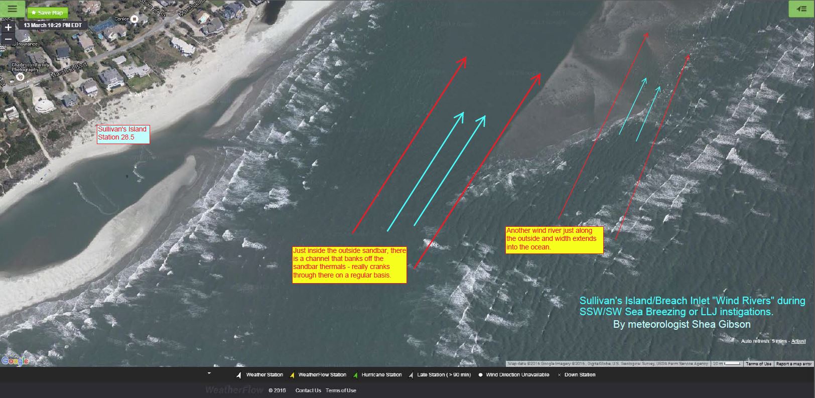
by WeatherFlow meteorologist Shea Gibson Ever been out on the water and notice there are systematically stronger areas of wind than others? Why would the wind be higher near sandbars/shallow waters than right at the beach? Why would there be strips of wind that seemingly follow the same tributaries or spit functions as water does?…

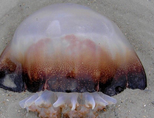
By WeatherFlow meteorologist Shea Gibson. Each year, I enjoy finding out when the Cannonball Jellyfish arrive in the Charleston, SC area. Other than being a delicacy sushi grade for Asian countries… or another one of those things that go “bump” in our dark murky waters (but don’t worry – they don’t sting), they signify a couple…

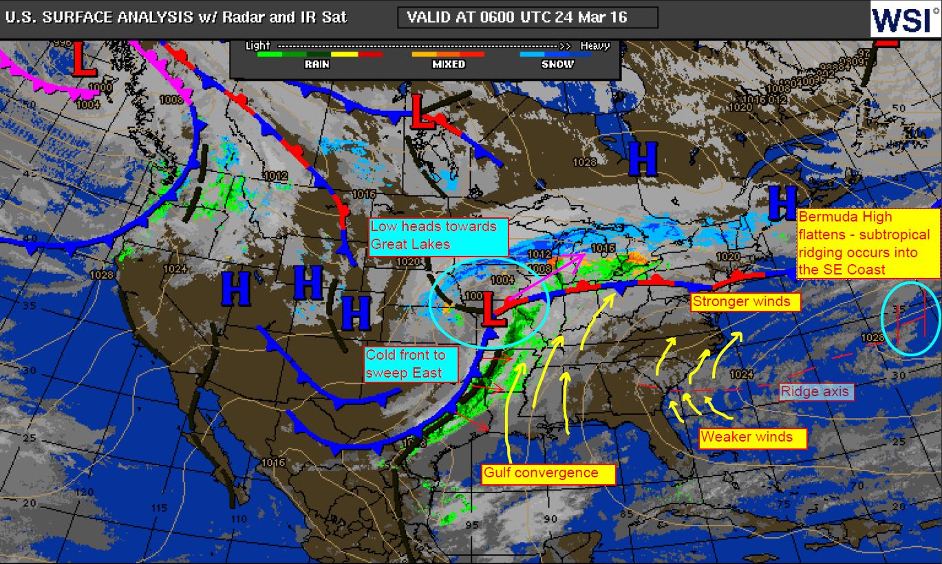
By WeatherFlow meteorologist Shea Gibson Every year during the warm season starting about now, we see Bermuda High pressures occasionally flatten out over the Atlantic. In turn, it places its ridge axis point along the SE Region and sometimes the mid Atlantic states. Weaker winds, or what we call “doldrums” exist near and just along…

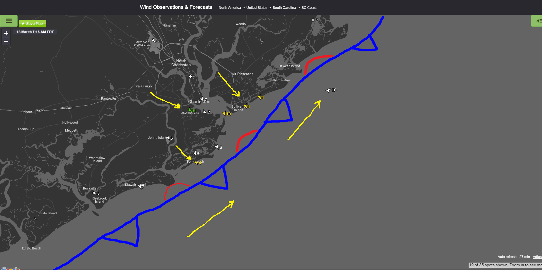
by WeatherFlow meteorologist Shea Gibson How do we know where cold fronts are actually located? Sometimes using radar scans and satellite imagery can be confusing and “cloud” the issue (below pic using the GRE radar with Water Vapor) But other times, it’s as easy as using our own weather station mesonet (which also provides air temps/pressures…

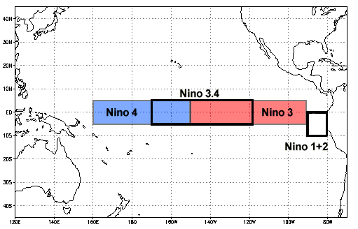
by WeatherFlow meteorologist Shea Gibson Oceanic Niño Index (ONI) values suggest that El Nino region 3.4 is cooling. Current anomalic value is at +2.076, which means that El Nino is now showing signs of weakening as Sea Surface Temps there have fallen the lowest since August 2015. The prediction is for SST’s continuing to fall, with Neutral phasing…

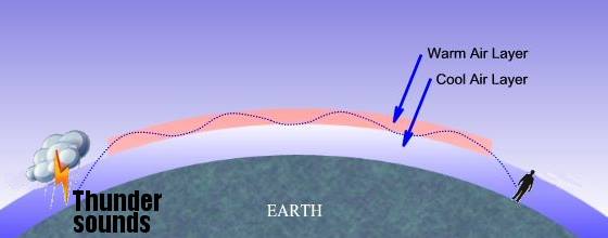
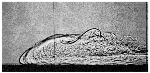
by WeatherFlow Meteorologist Shea Gibson Today we had quite thunderous sound with ground shaking reported along much of the Greater Charleston coast and inland areas. Many felt it could have been an earthquake, others a large explosion. Ok here it is explained…the loud shaking boom we heard today was a sonic boom from jet aircraft…

By WeatherFlow meteorologist Shea Gibson. In Part I, we discussed the general understanding of how Sea Breezes work. In Part II, we looked at the different classifications of Sea Breezes and how each one works. Now, in Part III, we move on to more advanced parts of the Sea Breeze. We’ll take a look at how…

By WeatherFlow meteorologist Shea Gibson Well it’s that time of the year for “marine layering” again as water temps have cooled to the upper 60’s to near 70°. I’ve been recording when marine layering starts for the last 2 years in order to further document the initiating time periods. In the 2013, it started on Friday,…
Massive North Pacific High brings NW winds to most of the California coast by Mike Godsey Yep it is mid fall the time of fading winds on the California coast as the North Pacific High shrinks and moves southward away from the Golden State. The time of year when the days are shorter and the temperatures…

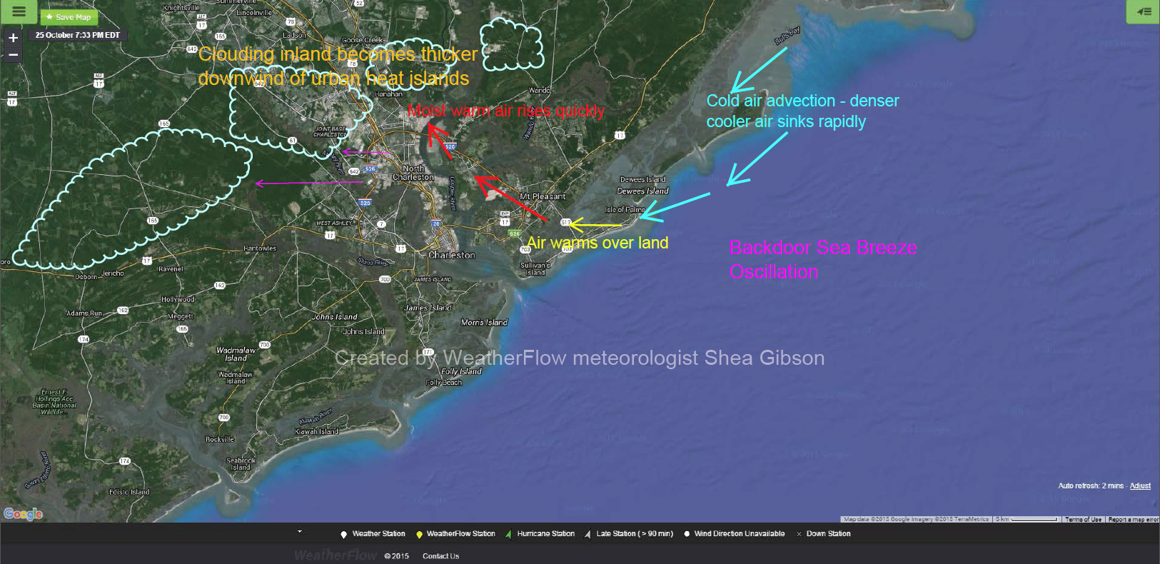
By WeatherFlow meteorologist Shea Gibson 10/31/2015 Many are well aware that our coastline is very fragile as air masses over warmer land and cooler waters interact with each other. In some cases, we have avenues of acceleration called Sea Breezes as these two air masses work to create a circulation or oscillation of air. There are various types and classifications of…
