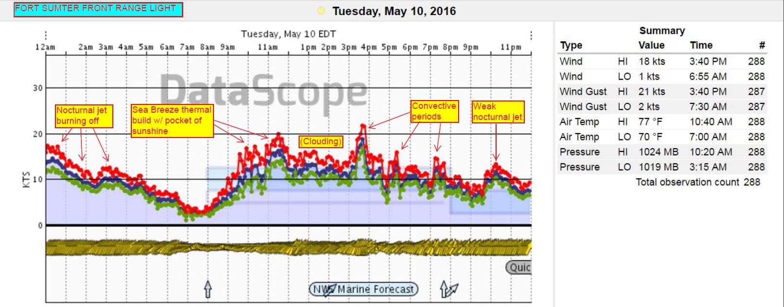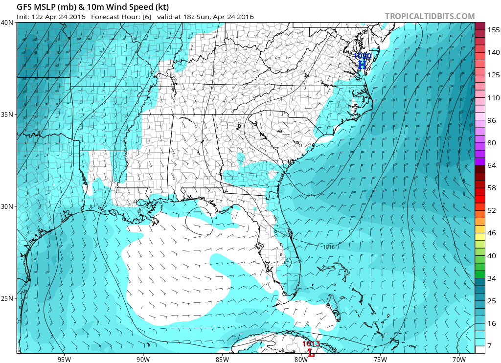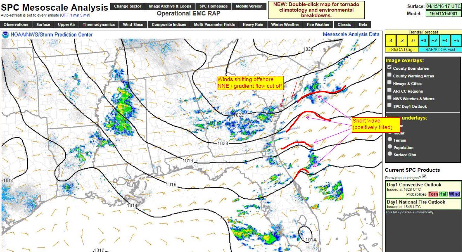
by WeatherFlow meteorologist Shea Gibson Ever heard the terms “nocturnal jetting”, “overnight jetting” or “evening surge”? This happens when there is what is called an atmospheric “inversion” in the troposphere that traps a cool layer (radiational cooling of land overnight) at or just above the surface beneath a warm layer with a ribbon of fast…
by WeatherFlow meteorologist Shea Gibson Here is the NASA SPoRT Center Sea Surface Temperature loop that goes from May 20 to present. Notice the cool water up-welling eddies in the Gulf Stream off of the Southeast coast created by both Tropical Storm Bonnie and Tropical Storm Colin. We could say “footprints” over the water in this…
By WeatherFlow meteorologist Shea Gibson Here is the latest update for Invest 93L, which could become Tropical Storm Colin. Be safe and have a plan this year! ~ Shea Twitter: @WeatherFlowCHAS Facebook: www.windalert.com and “Shea Gibson – WeatherFlow”
by WeatherFlow meteorologist Shea Gibson Latest update from 9:30PM, Saturday May 28, 2016 (apologies clipped myself bottom right out due to resolution change in output).

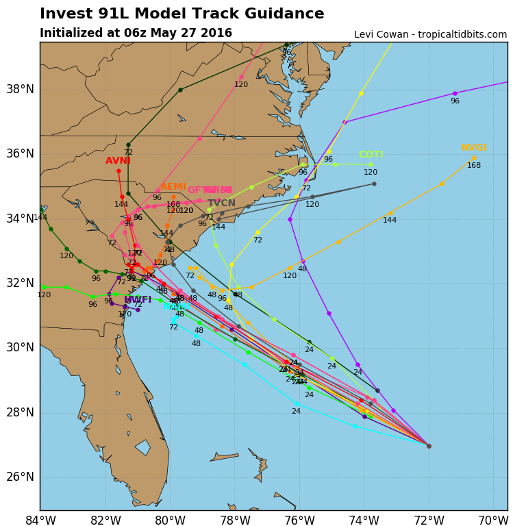
by WeatherFlow meteorologist Shea Gibson TROPICS UPDATE / WEEKEND OUTLOOK 5/27/16 – 5/29/16: Watching Invest 91L, which is still encountering some residual upper level shear and expected to move into an area more favorable for development as it drifts towards the SE coast. As of 7:45AM today, the NOAA NWS National Hurricane Center has now…

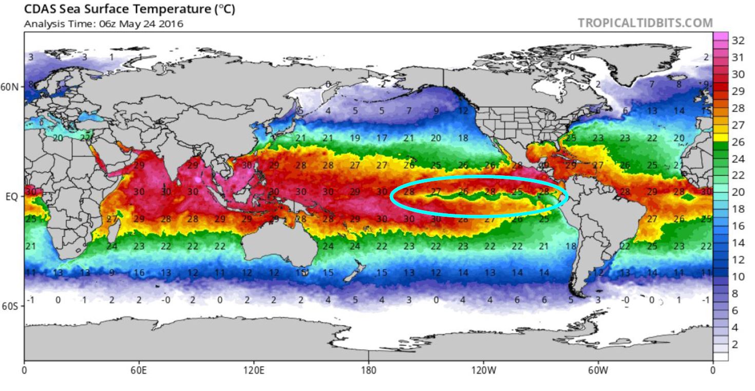
by WeatherFlow Meteorologist Shea Gibson As many now, we had quite a strong El Niño develop in the central and eastern Pacific Ocean as Sea Surface temperatures soared to 3.1°C above normal (tying the previous record from 1997). Normal is considered as 28°C or ~82.4°F. The focus now is shifting towards a La Nina this year, in…

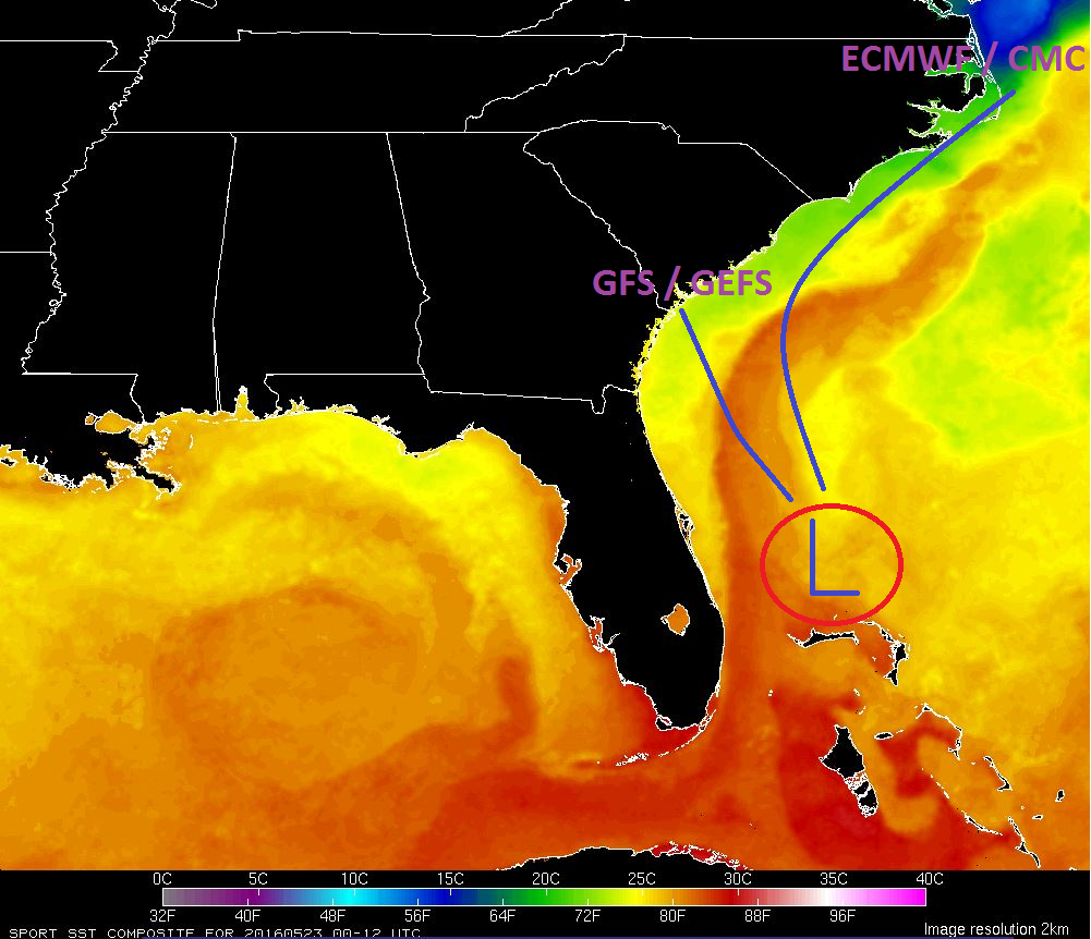
by WeatherFlow meteorologist Shea Gibson We are already watching for potential tropical development along the SE Region just a week before the start of the Hurricane Season 2016 that begins June 1st and runs through November 30th. With Atlantic basin waters warming up and overall air temps on the rise, we sometimes begin to see areas…

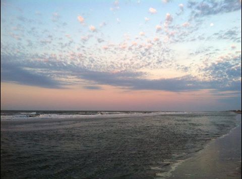
By WeatherFlow meteorologist Shea Gibson Yesterday, May 10, 2016, seemed like a fairly quiet day in the Charleston weather world with seemingly overcast/cloudy skies keeping the hotter air temps down while weakening the Sea Breeze along the coast. However, things are not always as simple as they may seem. What type of clouding was it and…

by WeatherFlow meteorologist Shea Gibson It’s getting warmer in the SE Region. which means our Sea Breezes are becoming more pronounced. Very visible on satellite imagery today! Wanna see something “cool”? Check out the Sea Breeze lines showing all along the Carolina Coast and down in Florida this afternoon keeping air temps down a few…

By WeatherFlow meteorologist Shea Gibson In weather, the “Northeast Wedge” is no unfamiliar guest to us that live along the Eastern seaboard of the United States that see elongated periods of driving NE winds and beach erosional processes. We frequently see the wedge setup as High pressures position themselves to the north in a winter-like pattern and…
