
Today, Friday, June 11, 2023, it really looks like another “Big Eddy” develops this Sunday. Drop to the bottom of this blog to see how it happens. For background, keep reading: Most of you know that our San Francisco Bay Area wind patterns are changing. The upper-level winds that make up upper ridges and troughs…
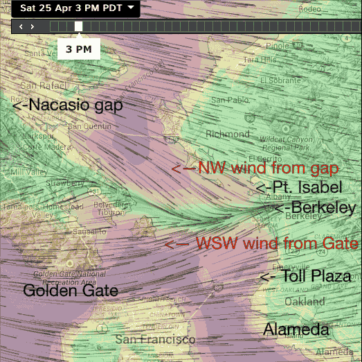
Hi Mac, In normal years the battle is between the “good” NW ocean winds that curve through the Golden Gate and become steady WSW winds that go towards Pt. Isabel and Berkeley VERSUS The “bad” winds are triggered NW winds aloft that come over the Nacasio and Fairfax gaps in Marin’s coast range. Those winds turn WNW…

Hi fxop, Great question! For a quick answer to your question about Kerry’s forecast, skip to the bottom. To really understand what is happening, here is some background. Palo Alto is less prone than 3rd. Ave. to that battle between the “Good” wind and the “Bad wind” that can spoil the winds in the sail/kite/wing area, especially at the launch. The forces…

For days now, the San Francisco Bay Area has been blessed or cursed by a counter-clockwise spinning west of the Golden Gate. You love the eddy pattern if you wind/kite/sail at most sites north of the SFO airport. But if you ply the water on the coast or south of the airport, you probably hate…
So, what is causing us to have day after day of strong NW ocean winds AND having a pressure gradient spread between Sacramento, Stockton and towards Bakersfield that is delivering wind to almost every site in the Bay Area? Usually, the North Pacific High stays near us for a few days and the winds are…

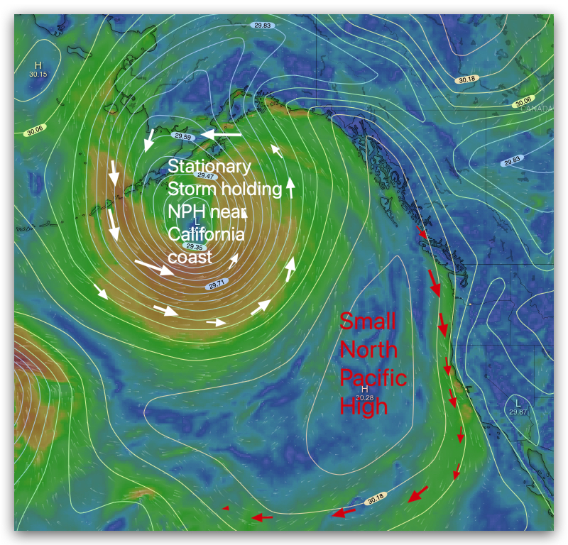
After experiencing strong NW winds from a massive 2500-mile-wide North Pacific High along the coast on Saturday, Sunday, and Monday, it may seem peculiar to read about weak southerly winds for a storm system on Tuesday. However, this sudden shift in wind patterns is not uncommon and can be explained by weather phenomena that are…

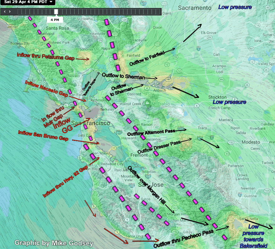
Yesterday I made a rare forecast for almost every site in the Bay to blow since the pressure gradient to the Central Valley was pretty evenly split between Sacramento, Stockton and towards Bakersfield. This set up was covered in yesterday’s blog. As you can see in the imagery below most sites reached or exceeded the…
Forecasting wind for the San Francisco Bay Area is extremely tricky compared to the Southern California, Baja or The Gorge. All those sites usually have inbound wind coming from the coast heading inland and typically from one direction. The Bay Area can have NW or W or SW or SSW ocean winds. Plus it has…

Mild NW winds return to the coast and the pressure gradient is pretty evenly split between Sacramento, Stockton and towards Bakersfield so most sites see wind to the shore. Sherman Island is gusting over 20 at dawn as forecast since the marine layer clouds have crested the East Bay hills. But those clouds will retreat…
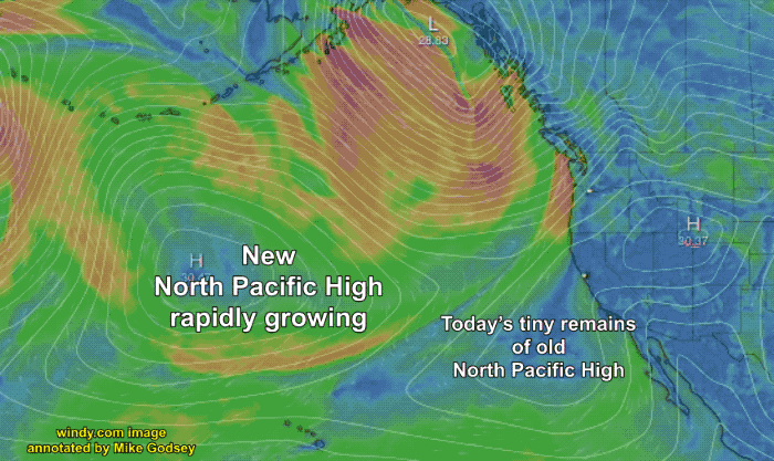
The North Pacific High was very active in Baja waters this spring but has provided scant strong NW winds for the Northern California coast this spring in March. This week a rapidly enlarging North Pacific High has formed north of Hawaii and will bring strong NW winds to the San Francisco Bay Area and the…