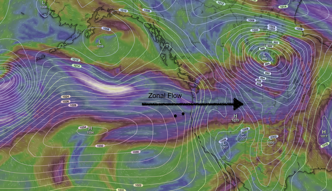
The image above depicts winds in the upper atmosphere. When upper level winds, at about 15,000 ft are blowing directly from the west in a straight-ish line, it is said to be Zonal. Often, a surface low pressure will be ahead, on the leading edge, and another surface low pressure on the trailing edge. This type of upper level set up will bring inland moisture/clouds off of the Pacific as well as cooler temperatures. We will see this setup tomorrow in the PacNW.