Thursday’s Eddy Wind Recipe:
It you are new to the San Francisco Bay Area summer winds you are befuddled right now. For weeks we have had NW ocean winds curving in to most sites.
But the handwriting was on the wall with 3rd. Ave. often plagued by W to WSW winds at the launch sites despite WNW winds out a the channel.
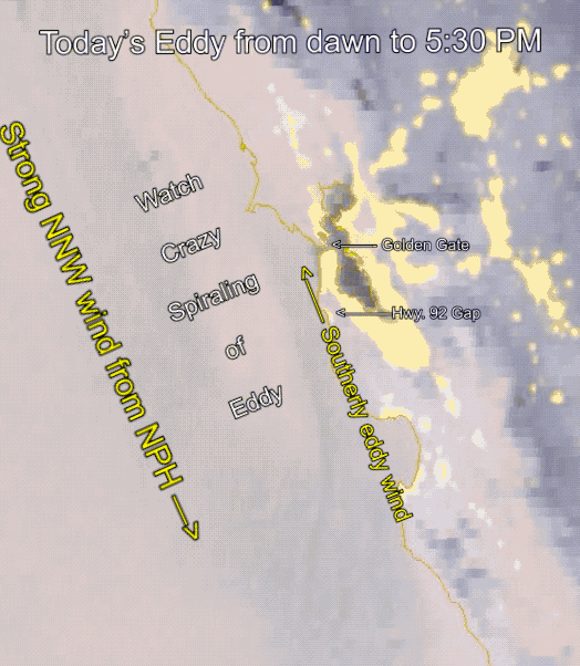
So it was bound to happen! We have made a switch from NW winds curving into the Bay to southerly eddy winds. Had the North Pacific High’s surface NW winds somehow disappeared? Nope, they are still there but Eddy has set up a temporary fiefdom along the coast and its southerly eddy winds rule.
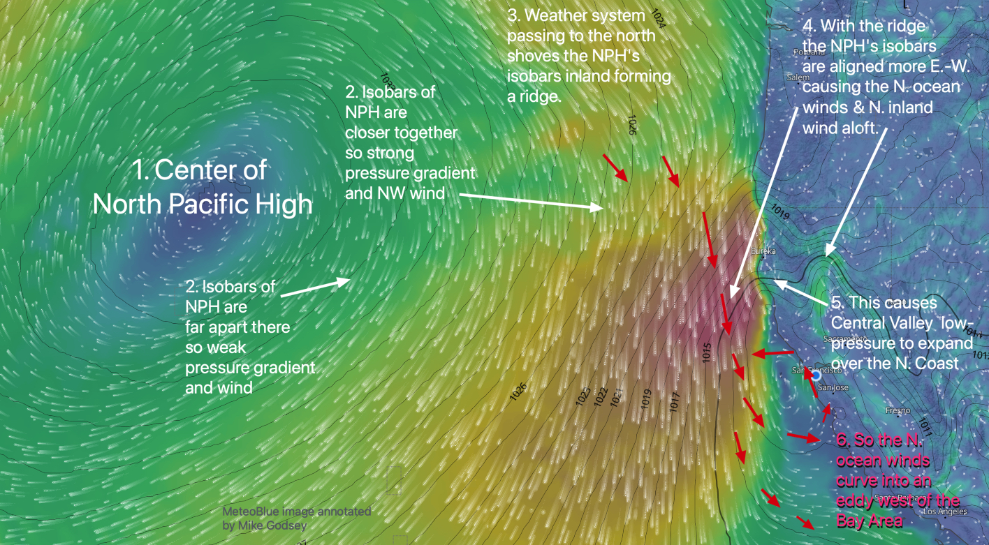
1- Alaska storm continues to distort the NPH, keeping a ridge over far Northern California.
2- This make our ocean winds west of the Farallon Islands (18 miles west Gate) more N than NW.
3- It also causes low-pressure from the Central Valley bulge over the N. coast.
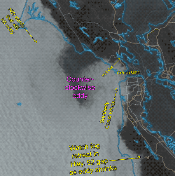
This creates an S. to N. pressure gradient, so the N. wind curves into a long eddy from Monterey to Pt. Arena.
4- It also produces low-pressure Sacramento to Redding.
5- Voilà, as fog clears, upper-teens to low 20’s+ winds mid Golden Gate to Sherman Island.