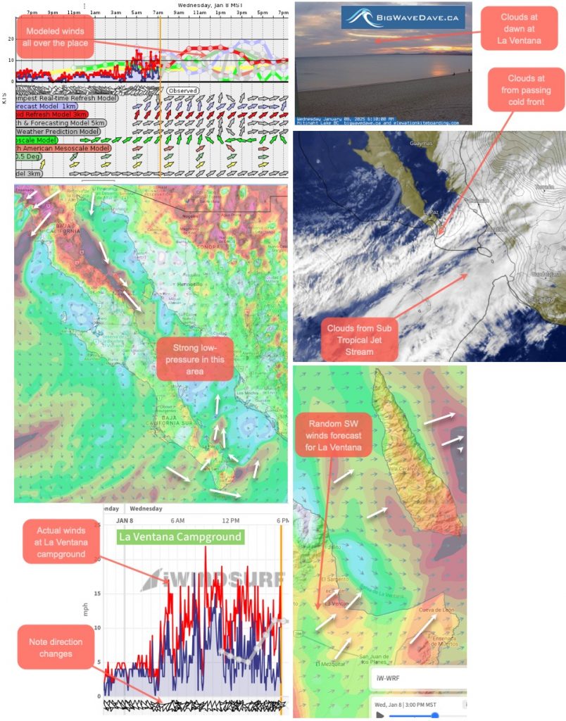
Note: This autopsy imagery covers the impact of low-pressure over the Sea of Cortez on Baja’s East Cape winds. Tragically, that same low-pressure helped created massive Santa Ana winds in Southern California creating nightmare fire conditions. That event will be covered in an upcoming blog.
Here is the text part of my wind forecast for yesterday January 9, 2025
Today’s Wind Recipe: More Basura wind ingredients in todays recipe.
1. 60 knot WSW winds blast over us from a near Cut Off Low at ≈ 18,000 feet.
2. This induces a surface low-pressure near the middle of the Sea of Cortez creating strong El Norte winds from San Felipe to Mulege and strong sporadic unfavorable WEST winds near the La Ventana launch sites.
3. Since this wind is in an offshore direction and has to go over mountains it often does not reach the shore except randomly at the mouth of arroyos.
4. Meanwhile, a passing cold front brings cooler temperatures and clouds mostly south of us.
5. Lurking south of us is the dreaded Sub Tropical Jet Stream but it does not get added to today’s recipe disaster.
Note: Again, the AM glassy waters use caution fishing and kayaking near arroyos since there is a chance of random strong WEST wind blasts.
La Ventana Area: UP AND DOWN W-WSW wind sometimes re

