When a Cut-Off Low moves over Baja California during the winter, it can significantly impact surface winds and weather in the region. Here’s what typically happens:
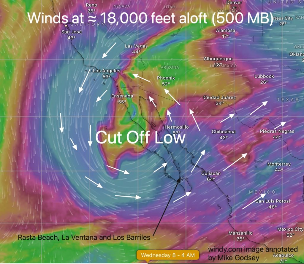
Cut-off lows are an upper low “cut off” from the main jet stream with upper winds spinning around the low-pressure center. Since they are no longer attached to the main flow of the jet stream that normally moves weather from west to east they can move slowly or stall. This can prolong adverse weather conditions in the region for several days.
This also makes the location of the upper Cut Off Low very difficult to predict. Indeed, Cut Off Lows are sometimes called the “Weather Man’s Woe”
At this time the usually reliable ECMWF model says a Cut Off Low will linger over the middle of the Baja Peninsula bringing several days of crummy winds to the Rasta Beach, La Ventana and Los Barriles launch sites. This first image shows what the ECMWF model suggests for Wednesday Jan 8.
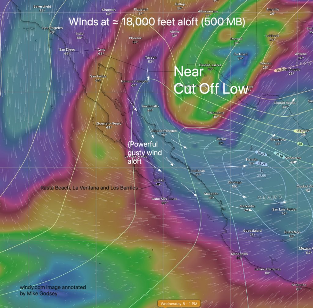
But… The GFS model has and near Cut Off Low over the border between Mexico and Texas creating northerly wind aloft over the Sea of Cortez which would help the forecast moderate El Norte winds it has forecast.
Models are always struggle with Cut Off Low and their accuracy suffers this far out anyway. But generally I find the ECMWF more accurate for Baja large scale wind although neither is very useful for forecasting beach winds.
So, here is what to expect if the ECMWF is correct:
1. Surface Winds
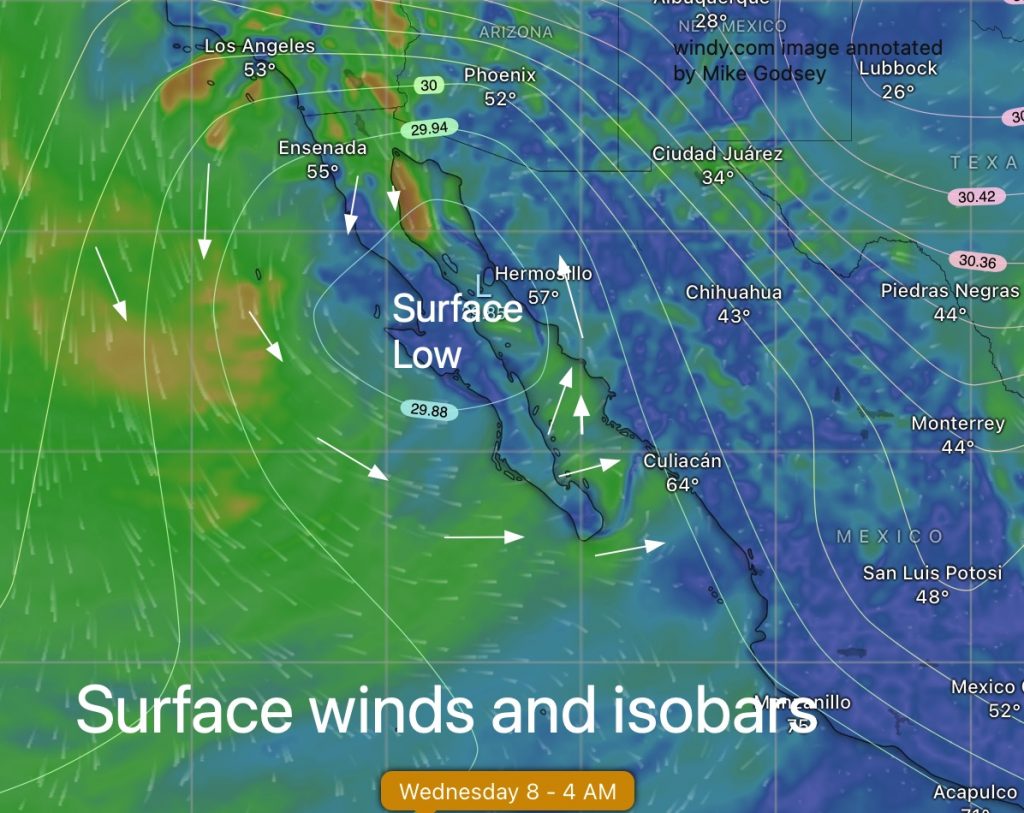
Increased Winds: Cut-off lows are associated with stronger pressure gradients, which often result in gusty winds, especially in coastal and mountainous areas.
Directional Variability: Winds can shift directions depending on the exact position of the low. For example:
If the low is west of Baja, surface winds may flow from the south or southeast, bringing moisture from the Pacific.
If it moves east, winds may shift to the north or northwest, introducing cooler and drier air.
Localized Effects: Topography in Baja can channel winds, causing localized accelerations, particularly in valleys and gaps.
2. Weather Impacts
Precipitation: A cut-off low often pulls in moisture, leading to rain. The rain can be:
Light to moderate over much of Baja.
Heavy in some areas, especially if the system stalls or interacts with additional moisture sources (like an atmospheric river).
Snow in higher elevations, such as the Sierra de San Pedro Mártir mountains.
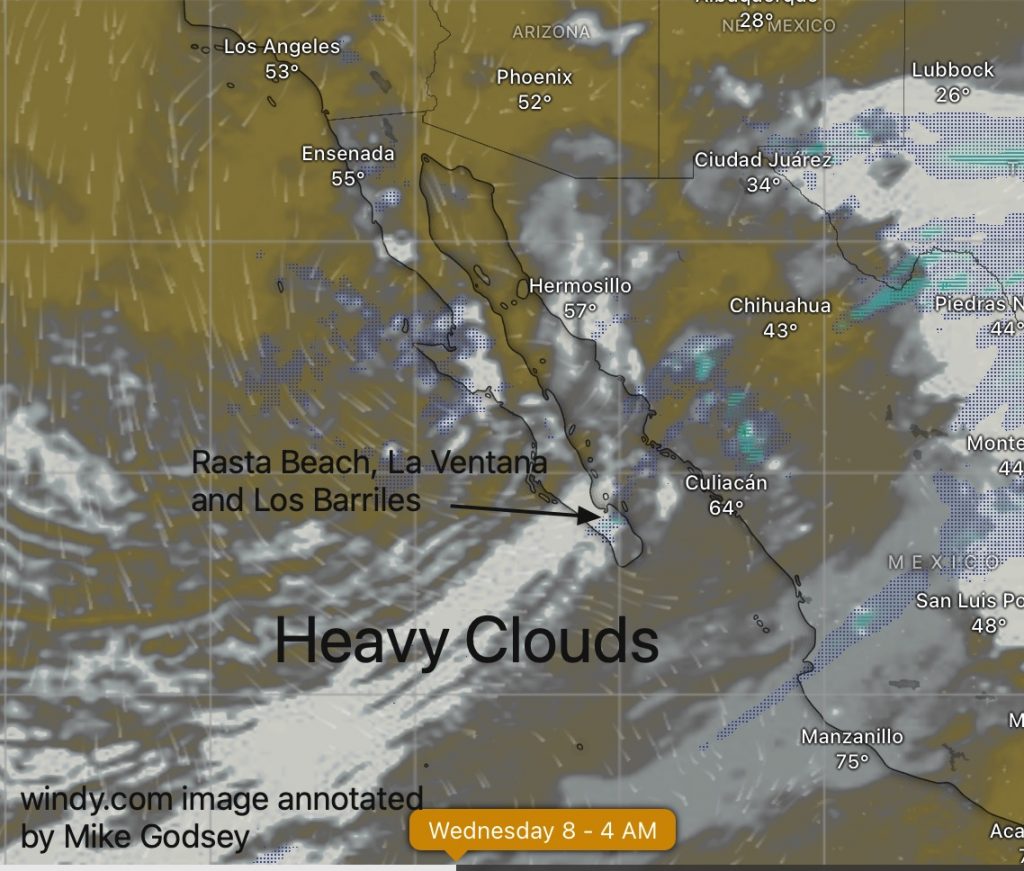
Cloud Cover: Extensive cloud cover often develops, with overcast conditions prevailing.
Cooler Temperatures: The cloud cover and precipitation can lead to lower daytime temperatures.
Severe Weather Potential: If the low is particularly intense or interacts with tropical moisture, it may produce thunderstorms with heavy downpours, hail, and strong winds.
3. Marine Impacts
- Over the Pacific and the Gulf of California, a cut-off low can generate rough seas and hazardous conditions for small craft due to stronger winds and shifting wave patterns.


