You know the old aphorism “If it looks like a duck, quacks like a duck…)
Well sometimes it isn’t a duck.
From the perspective of the La Ventana beaches it would appear that Sunday, Monday and today, Wednesday, we are having classic El Norte winds roaring down the Sea of Cortez.
As you old time La Ventana and Los Barriles regulars know El Norte winds are typically winter winds as high-pressure develop near the 4-Corners region (Where all the USA square states meet). Then if there is a low-pressure area south of Cabo strong northerly winds flow down the Sea of Cortez where they may be enhanced by local thermal winds.
So why are the current winds not quite duck like?
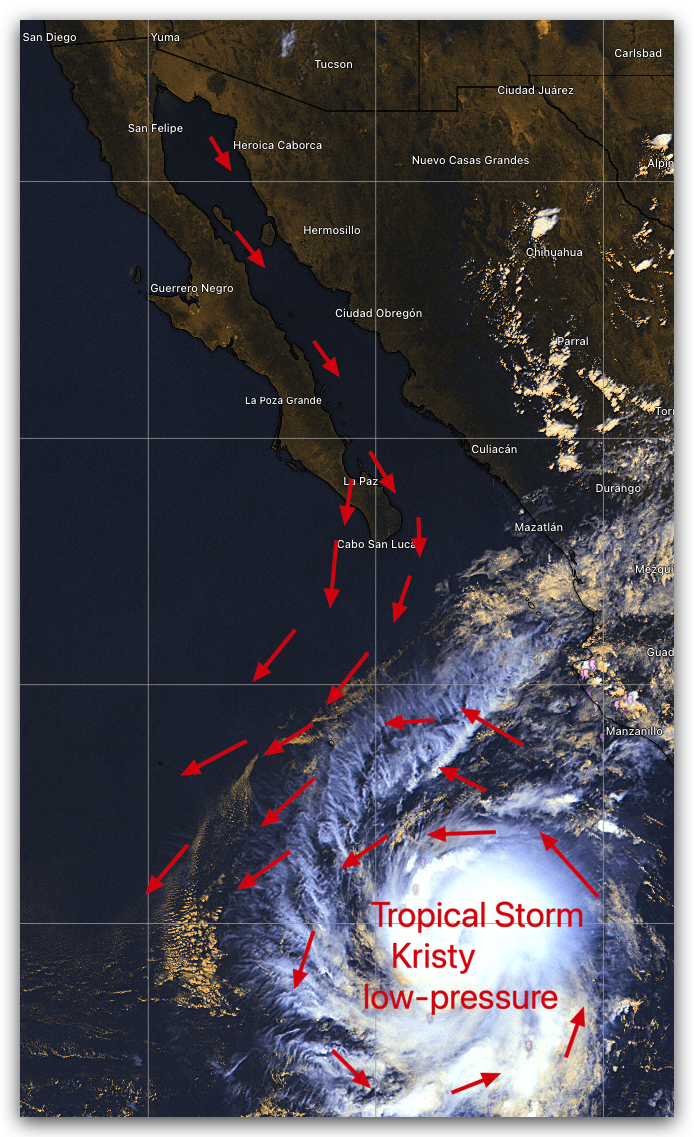
In this this satellite imagery notice the hurricane wannabe Tropical Storm Kristy. It sure looks hurricane but its peak winds are “only” 52 knots which relates Kristy to the mere Tropical Storm category. Wimp or not Kristy is a strong low-pressure area.
Now look at this second graphic.
Notice the WeatherFlow-Tempest ikitesurf.com sensor wind graphs. This data came from the La Ventana sensor at Ventana Windsports.
Those graphs sure quack like El Norte winds! But are these classic El Norte winds?
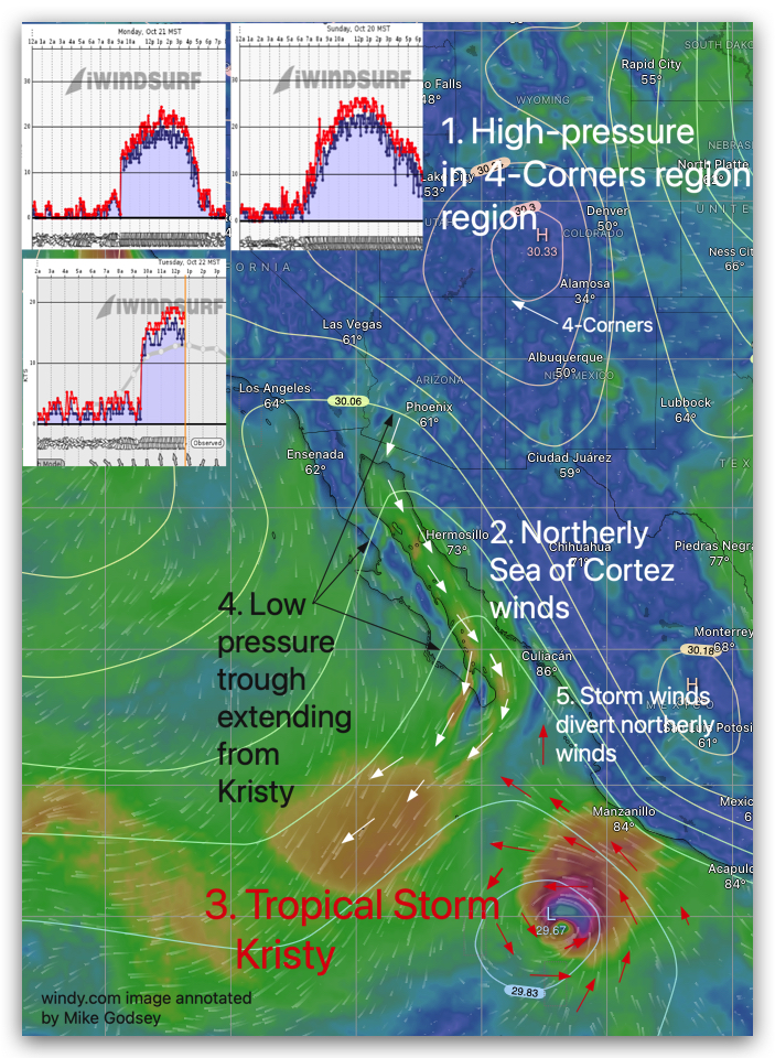
- Yep there WAS high-pressure in the 4-Corners region!
- Yep, northerly winds reaching Baja’s East Cape.
- But now things get weird! The pressure gradient between the 4-Corners region and the waters south of Cabo are not created by the normal winter-time low-pressure. Instead those northerly winds are shooting towards Tropical Storm Kristy.
- The northerly winds are also helped by a low-pressure trough extending from Kristy
- Even more interesting is the battle between the northerly winds trying to get to Kristy’s low-pressure and the easterly winds spiraling out from the Tropical Storm.
So, NO! Despite all the quacking this is not an El Norte Duck. And the factors that are producing these northerly winds actually continue, albeit mildly, into a 4th day, Wednesday since Kristy is only slowing waddling away from Mexico.