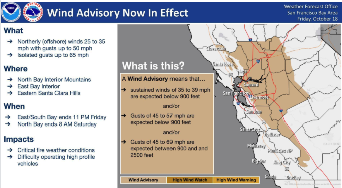
We are in a Diablo wind event with higher elevations seeing northerly wind gusts to 50 mph with Mt St Helena gusting as high as 75 mph. Red Flag fire conditions prevail.
Today’s Surface winds:
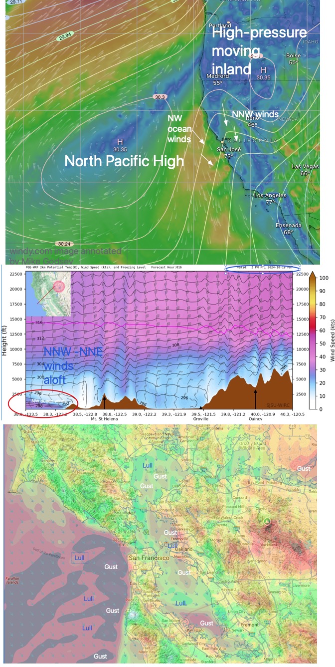
Strong unfavorable NNW/NNE winds aloft battle with moderate WNW ocean winds trying to curve into the Bay making for extremely patchy up and down wind. This occurs as…
1. Part of the North Pacific High moves far inland into far Northern California and eastern Oregon.
2. This creates unfavorable NNE winds from the surface to 10,000 feet in the AM.
3. These winds weaken near in the afternoon but still battle with the NW ocean winds in the afternoon. 4. The strongest winds are in the Ocean Beach to Waddell strip.
4. Inside the Bay the northerly winds hit Marin’s Coast Range and probably skip over the Crissy to Treasure Island zone.
5. Later in the afternoon there are BRIEF strong NW to WNW winds to the launch sites at Alameda and Coyote and 3rd but they FADE fast.
Overall, We see gusts and lulls marching across the Bay from the north.
The NWS has posted a High Wind Advisory: