by Mike Godsey
Historically the winds on Baja’s East Cape, Rasta Beach to La Ventana to Los Barriles corridor, begin to fade as spring approaches. This happens as the North Pacific High moves towards Alta California and high-pressure systems in Four Corners become less common.
This leaves Baja’s East Cape with only Local Sea Breezes that become progressively weaken and become more ENE to NE to E until they become an unfavorable onshore ESE direction. At this point the campground empties of wind junkes and many of the houses empty. And the villages of El Sargento and La Ventana become more like the quiet villages of decades past.
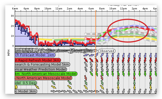
However, mid March 2024, the La Ventana Weatherflow (Tempest.Earth) sensors saw several days with upper-teens to low 20’s winds that brought out hundreds of wingers, kiters and windsurfers.
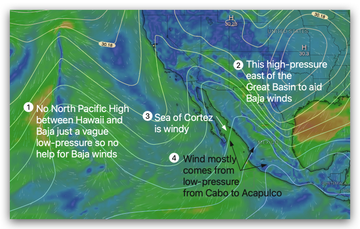
This graphic shows that there was no sign of the North Pacific High and its NNW Sea of Cortez winds. Nor was there high-pressure the Great Basin that sometimes create N. winds.
Instead most of the wind came from a strong low-pressure area, represented by the white isobar line, in the Los Cabos to Acapulco area.
Since northern Baja and Sea of Cortez are significantly cooler than Baja Sur and the southern Sea of Cortez the air is cooler creating a weak high-pressure area. So there was a pressure gradient in Baja’s East Cape waters.
Add to this the local pressure gradient caused by Coastal Valleys heating and you have very useful winds.
These winds were unique since they started earlier than normal in the AM and faded abruptly in the late afternoon. They were also more NNE so they fill nicely to the beaches unless we have clouds.
Surprisingly, all the models forecast this atypical pattern very well. So… Enjoy!!!
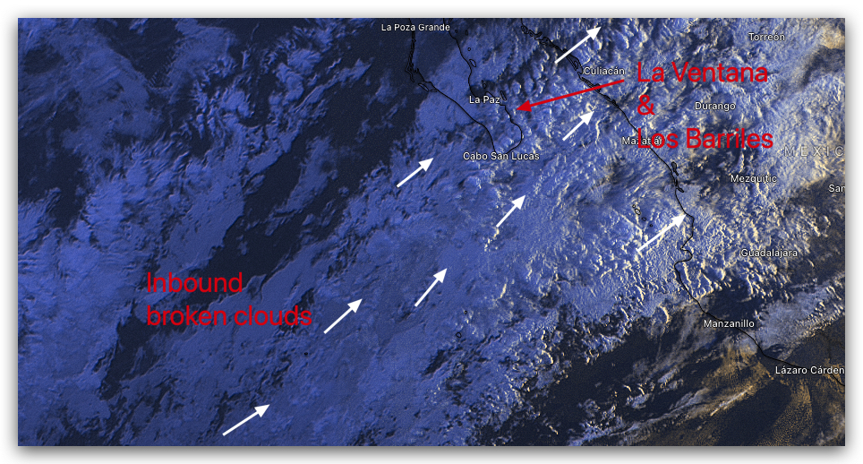
Today, March 19, there is a wrinkle in this forecast pattern. Heavy clouds are streaming over Baja’s East Cape which could keep the wind away from shore. Here is our enemy and why I am somewhat optimistic despite the dreary dawn.


