 How strong will the NW wind be?
by Mike Godsey
For over a week I have been mentioning NW winds for the Bay Area around Tuesday Mar. 22. But if you look at the extended forecast each day you will notice that the forecast wind range is larger than normal: “Upper teens to mid 20’s”
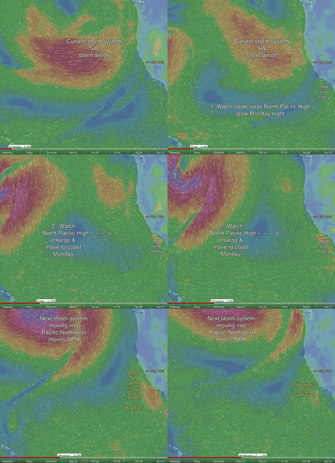
Why? Because as you can see this animation this is going to be a very rapid event and the key to getting strong wind will be the perfect combo of:
1. the actual location of the NPH.
2. The perfect synchronization with the increasing pressure gradient to the Great Basin.
3. The arrival of the strong winds aloft at the right time. If any one of those variables is off then we will only reach the upper teens at a few sites near the coast. If they all synch perfectly we could see gusty mid 20’s at sites near the coast.
I am not forecasting today or tomorrow but right now it looks like the North Pacific High’s surface NW winds will focus more from Waddell south so I would guess the Bay Area sees Tuesday winds more in the lower part of the forecast range.

