by WeatherFlow meteorologist Shea Gibson
How do we know where cold fronts are actually located?
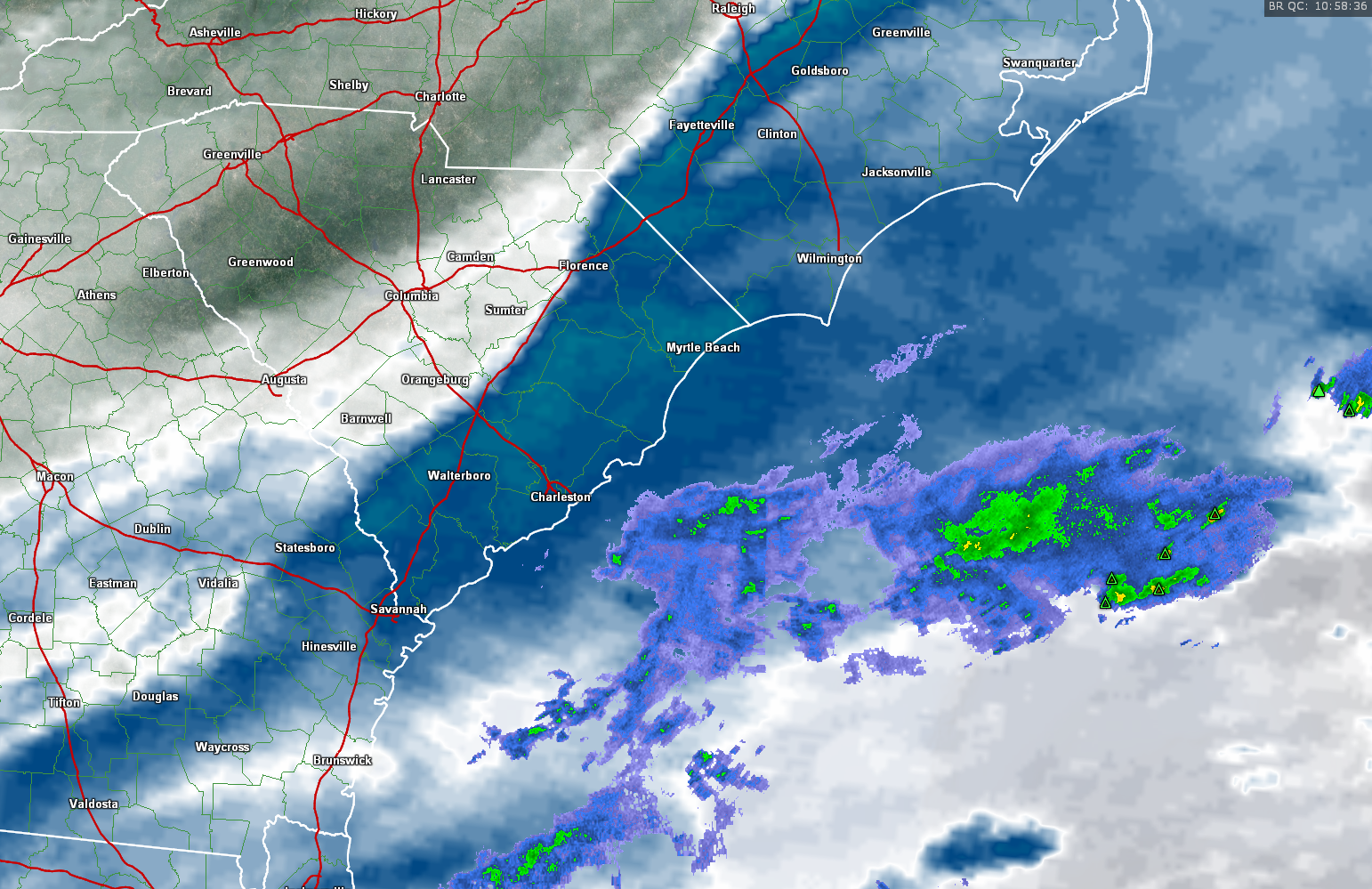
Sometimes using radar scans and satellite imagery can be confusing and “cloud” the issue (below pic using the GRE radar with Water Vapor)
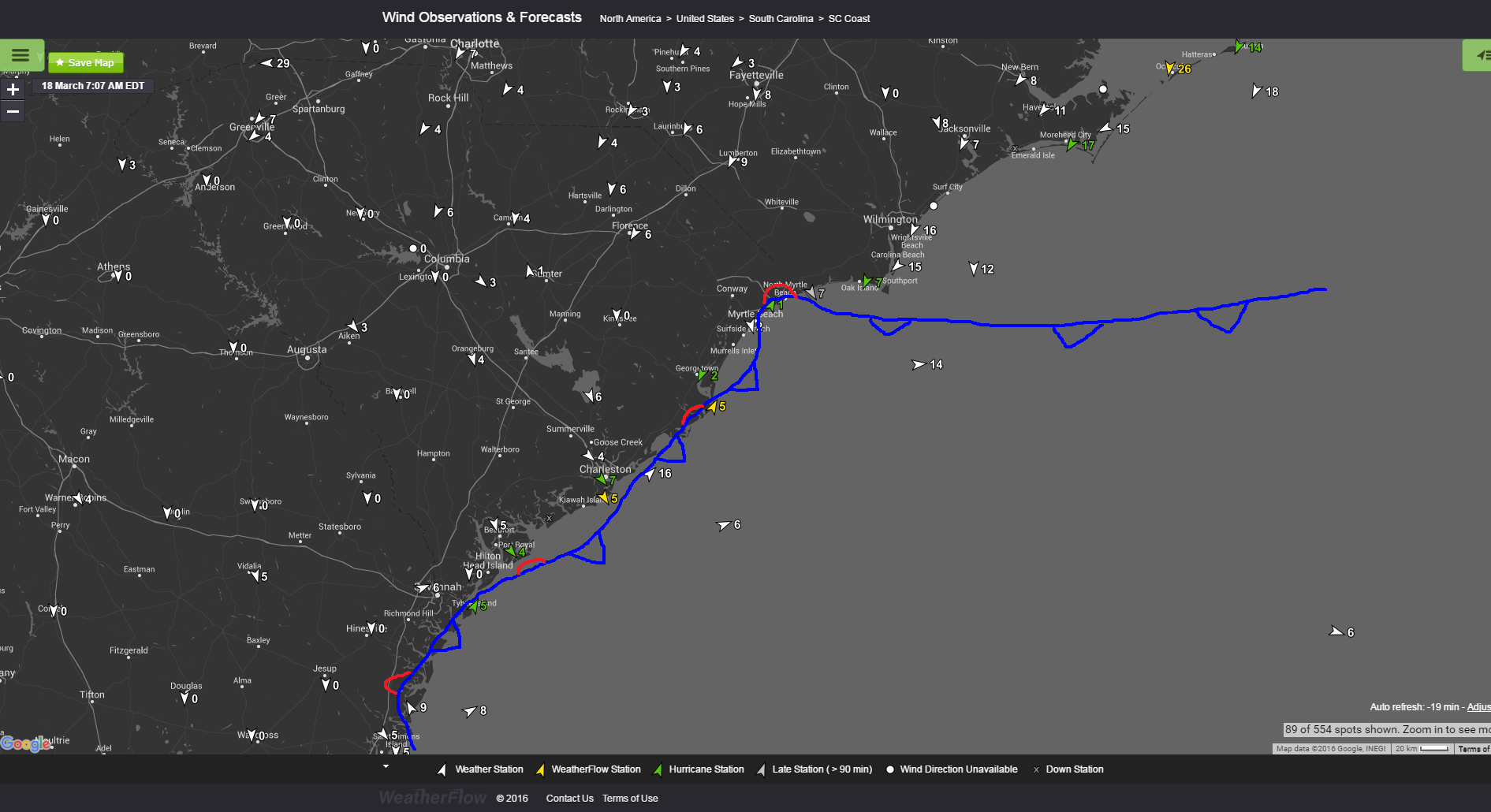
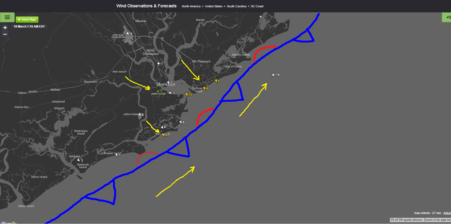
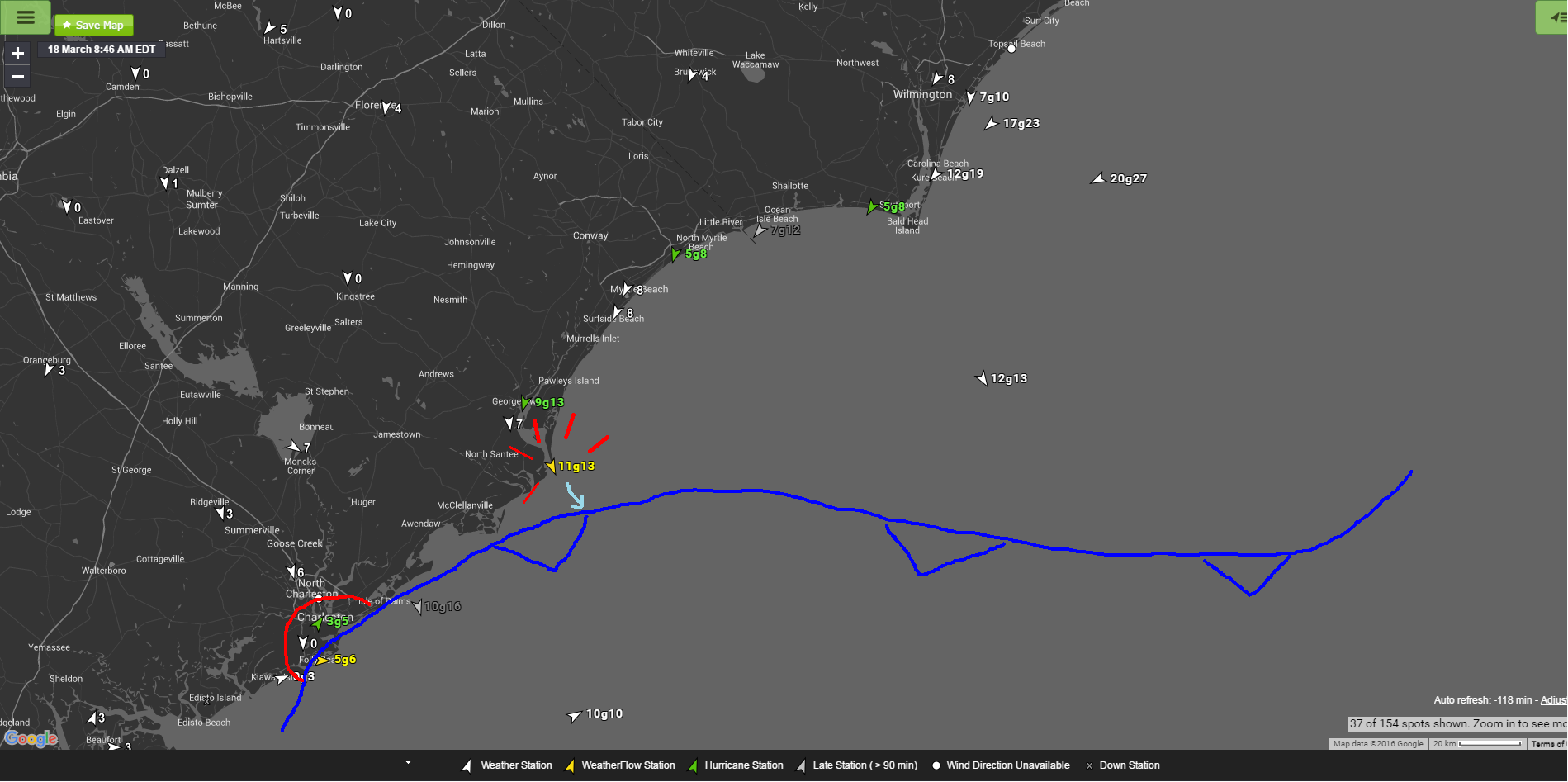
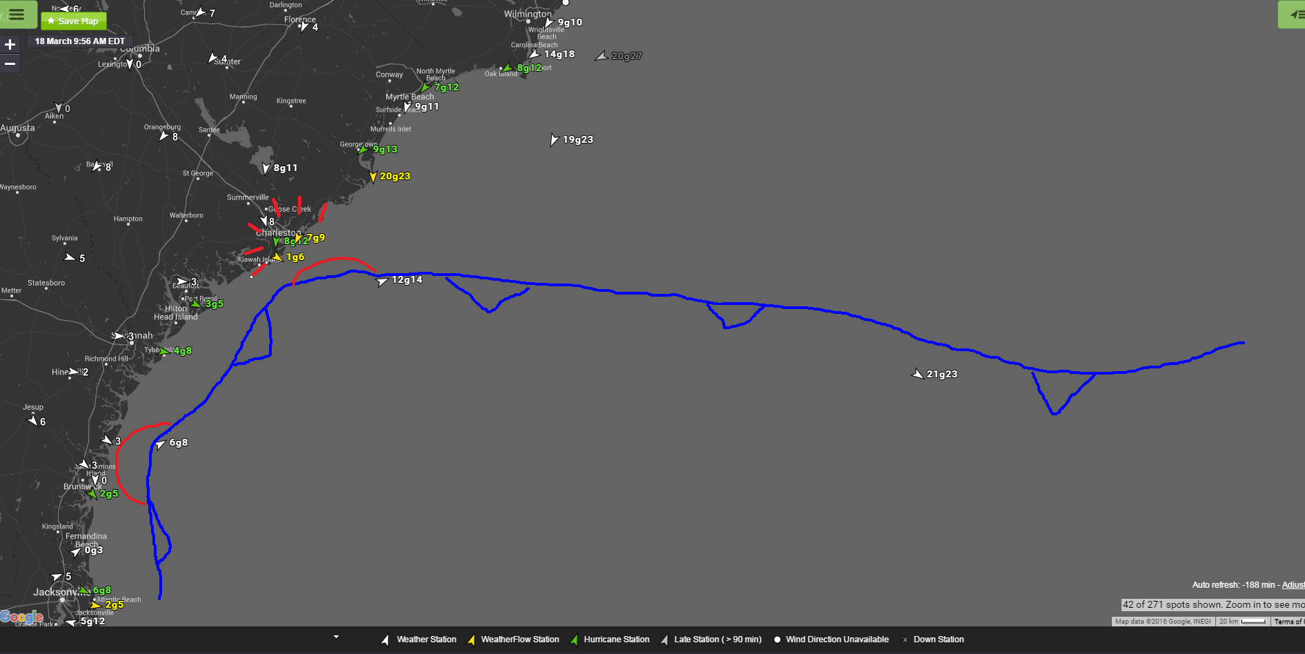
But other times, it’s as easy as using our own weather station mesonet (which also provides air temps/pressures for changes) and others to see what the surface winds are doing to literally draw a line. Here’s a tricky serpentine-like and nearly stationary boundary sitting along and just off of the Carolina coast this morning. High pressure to the north is slowly working a moderate NE/ENE flow down the coast as it undercuts the front and “wedges” it to the south.
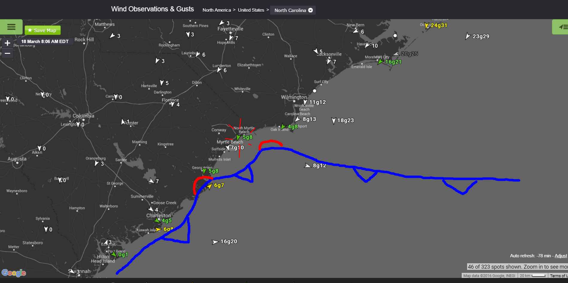
Our stations are the yellow and green arrows in these two pictures.
UPDATE: At ~7:45am, the boundary popped loose from Myrtle Beach and looks to unzip from the coast as that NE wedge works down. Looks like Winyah Bay is holding on for a bit just to the south of Georgetown,SC. One thing to notice is that a fairly strong gradient to the north is showing 24 g31kts at Ocracoke, NC.
UPDATE 8:45am: Front pops loose from the Georgetown/Winyah Bay areas. Next piece to unzip will be Charleston, SC.
UPDATE 9:45-10:00am the front has exited the Charleston area and Northerly winds are building down. That pretty much does it for this front today.
You can access our private mesonet via:
www.windalert.com
wx.ikitesurf.com
wx.iwindsurf.com
www.sailflow.com
www.fishweather.com
Cheers!
Shea Gibson
WeatherFlow Meteorologist
Outreach/New Weather Station Projects
Twitter: @WeatherFlowCHAS

