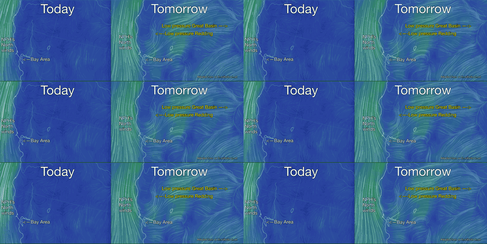
 Well, it has been a weird season and a marine surge is possible.
by Mike Godsey
Wow! Take a look at the difference in the surface winds today and tomorrow. I have been issuing a Marine surge ALERT! in the forecasts for several days now. This is still an iffy forecast for a simple reason: Marine surges are summer critters.
 Although there can be several different causes but the result is a sudden increase in the depth of the marine layer clouds that thrust
  though the Golden Gate and the Hwy. 92 gap and southerly winds that sweep all the way to Sherman Island. If you are new to the Bay Area and marine surge take a look at this time lapse video which shows a marine surge in action.
But this is late Sept. and typically the Sherman Island season is over by now. Even as I have been issuing a Marine surge ALERT! in my forecasts for Tuesday, Sept. 22 I have been half expecting that the variables would change and I would be back pedaling but now 24 hours before I expect the marine surge to begin its ramp up all signs are GO!
This is not only a unseasonal marine surge it also has an atypical cause. The marine surge tomorrow morning starts typically as the Central Valley thermal low finally retracts from the coast so the nagging heat wave begins a fade.
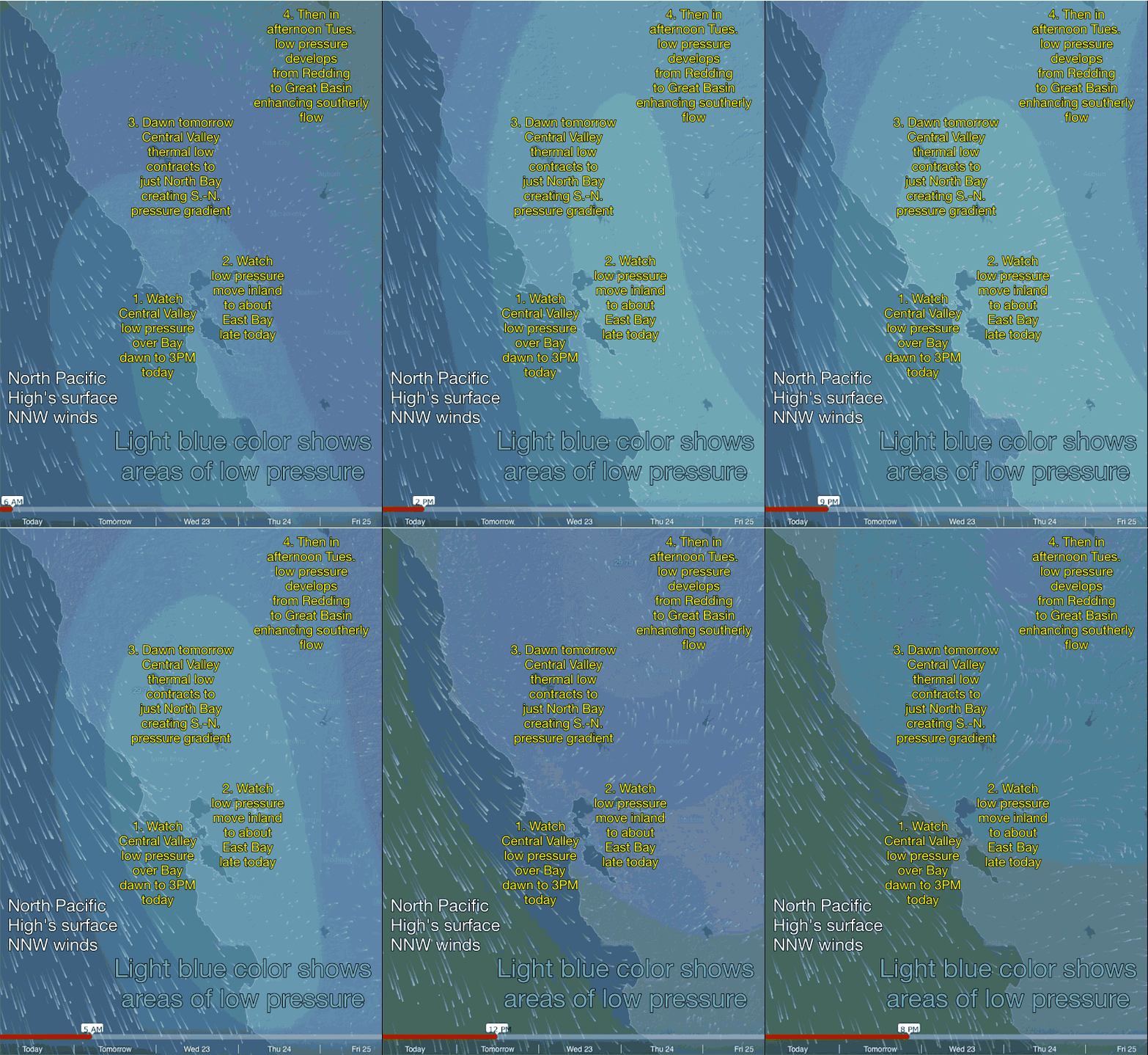
Looking at the model animation to the left the low pressure areas are in light blue.
Notice that today the Central Valley thermal low is is all the way over the coast in the morning and early afternoon. This means there is no pressure gradient to suck the ocean winds into the bay.
Then watch as the low pressure pulls back to near the East Bay which allows modest wind this afternoon.
Tomorrow the heat wave begins to subside. As this happens the retreating low pressure leaves a lobe of low pressure over the North Bay creating a mild southerly pressure gradient and Sherman Island, which has been dead for days, should se some mid to upper teens winds tomorrow morning. Normally this time of year all Sherman would see would be a fizzled marine surge.
But keep watching the animation and you can see that in the afternoon a deep low pressure develops over Redding which enhances to marine surge. Then the low pressure suddenly balloons and spans the area from the N. Central Valley all the way into the Great Basin .
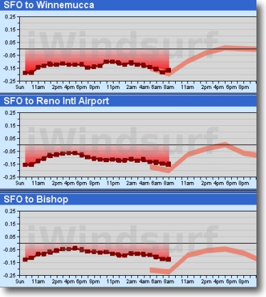
Winnemucca, Nevada may not be high on your must visit list but it and the other Great Basin sites show a dramatic pressure change tomorrow afternoon.
This pressure change causes the northerly wind of the North Pacific High to make a major curve over the  Bay Area so we have southerly wind that focuses in north tower of the Golden Gate past Point Blunt and over the northern East Bay all the way to Sherman Island.
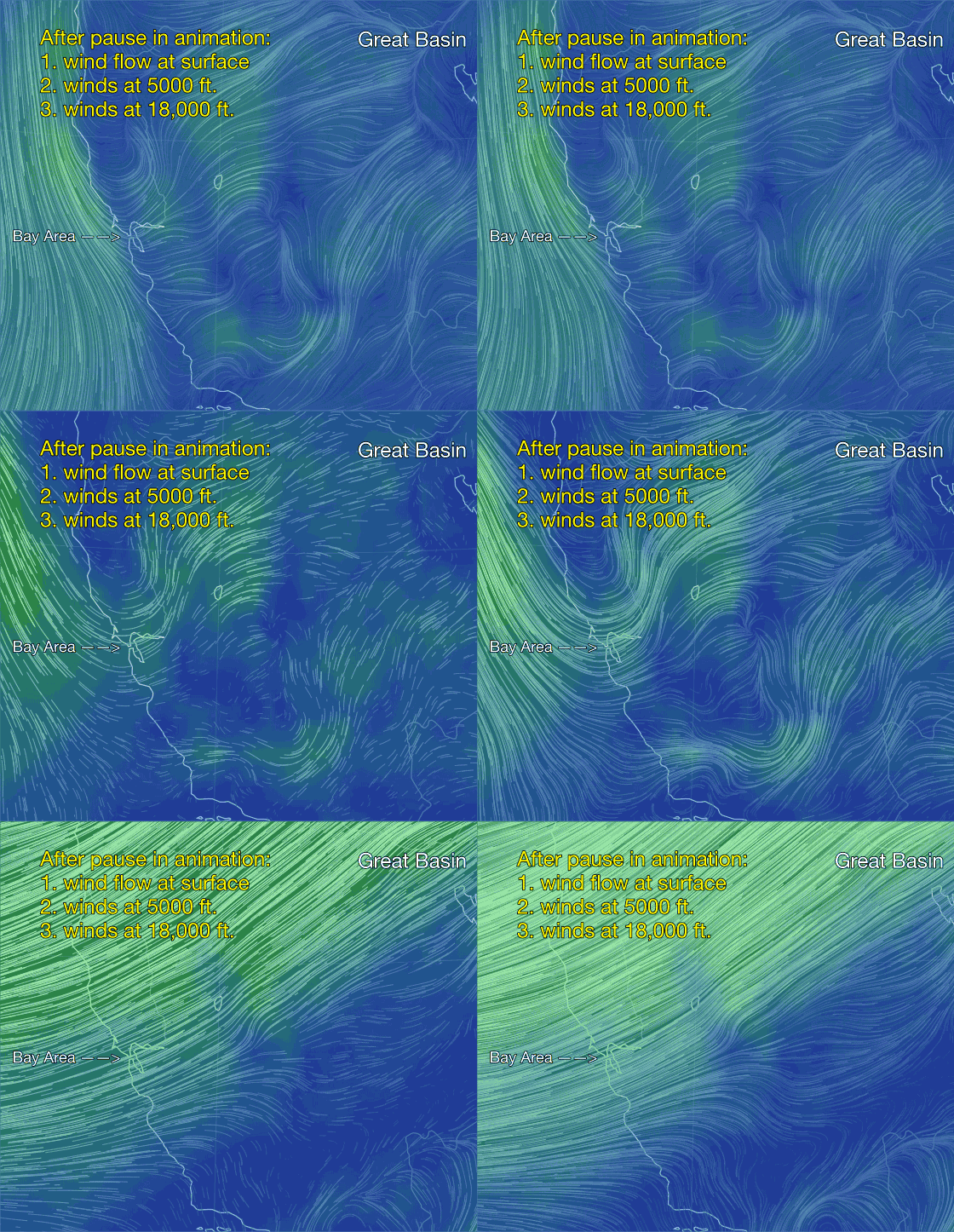
Meanwhile as you can see in the last animation the winds aloft further support the notion of a marine surge. Especially note the sharp kink the 850 mb winds that will transfer some wind to the hilltops. When this happens Sherman Island, which has no topography to the SW for a long ways usually has enhanced winds.
Obviously this is complex scenario and I could be proved wrong since it is always safer to forecast for typical expectations but if I am right Sherman Island will se low to mild mid 20’s tomorrow afternoon.
