Combo of massive NPH and unusual venting thermal low in Basin promise strong wind!
by Mike Godsey
Most models and forecasts promise strong wind this Friday and through the weekend.
You all know the mantra: high pressure over the ocean extending towards Portland and low pressure towards the Columbia mean good wind. But exactly what do these high pressure low pressure critters look like.
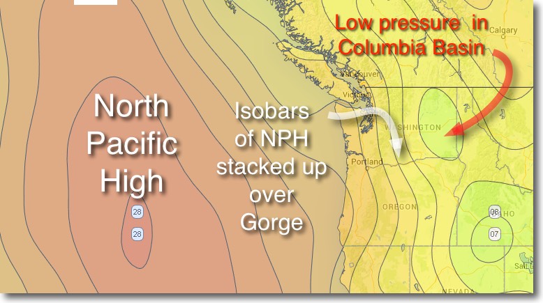
Looking at the top image find the NPH centered about 700 miles west of the Oregon coast.
You can think of the North Pacific High as huge area where air from the tropics descends from aloft. As this air descends  close to the surface it compresses creating a high pressure zone. All this descending air creates a dome of high pressure which we call the NPH. The isobar lines show areas of equal pressure. The closer the lines are together on the dome of high pressure the stronger the pressure gradient. Think of the elevation lines you see on a topographic map and you got the picture. You might expect this wind to flow straight out from the surface of the NPH however since the earth rotates the wind actually spirals out from the center in a clockwise fashion.
When the NPH is near the Oregon coast it brings northerly winds to the coast. When it is closer to Hawaii it brings NE trade winds.
Now look at the same image and find the thermal low pressure in the Columbia Basin. Basically as the summer sun, or in this weird year the spring sun, heats the land of the Columbia Basin the surrounding air is warmed. As this warm air expands it creates a low pressure area. The greater the heating the lower the pressure.
So now you have high pressure to the west and low pressure to the east. And the isobars are closest together near the Gorge. (See note below.)
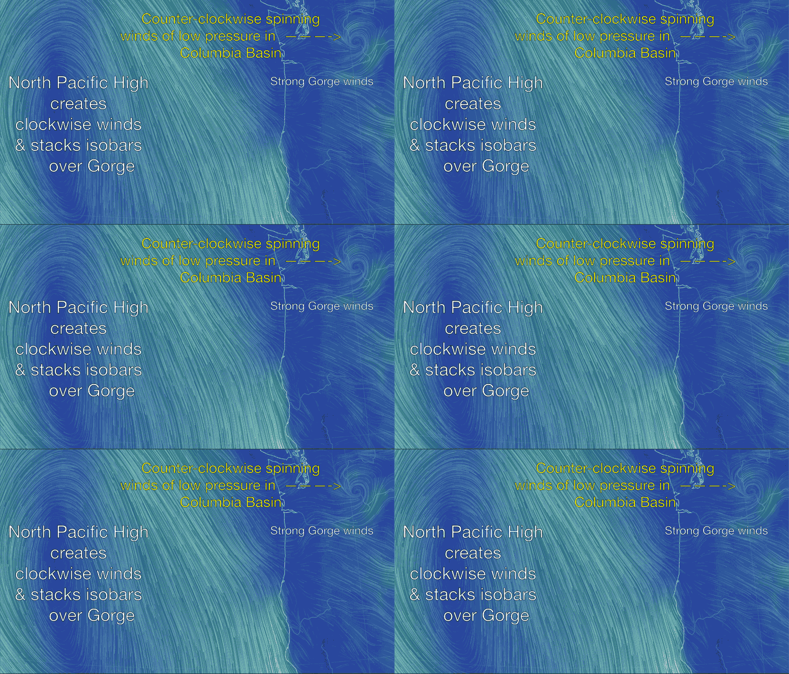
Now look at the animation and check out the clockwise winds of the NPH. Now zoom your mind into the area just west of
the Oregon coast. Notice how some of the NW wind from the NPH peels off and heads towards the Gorge as if feels the pressure gradient induced by all those tightly stacked isobars over the Gorge.
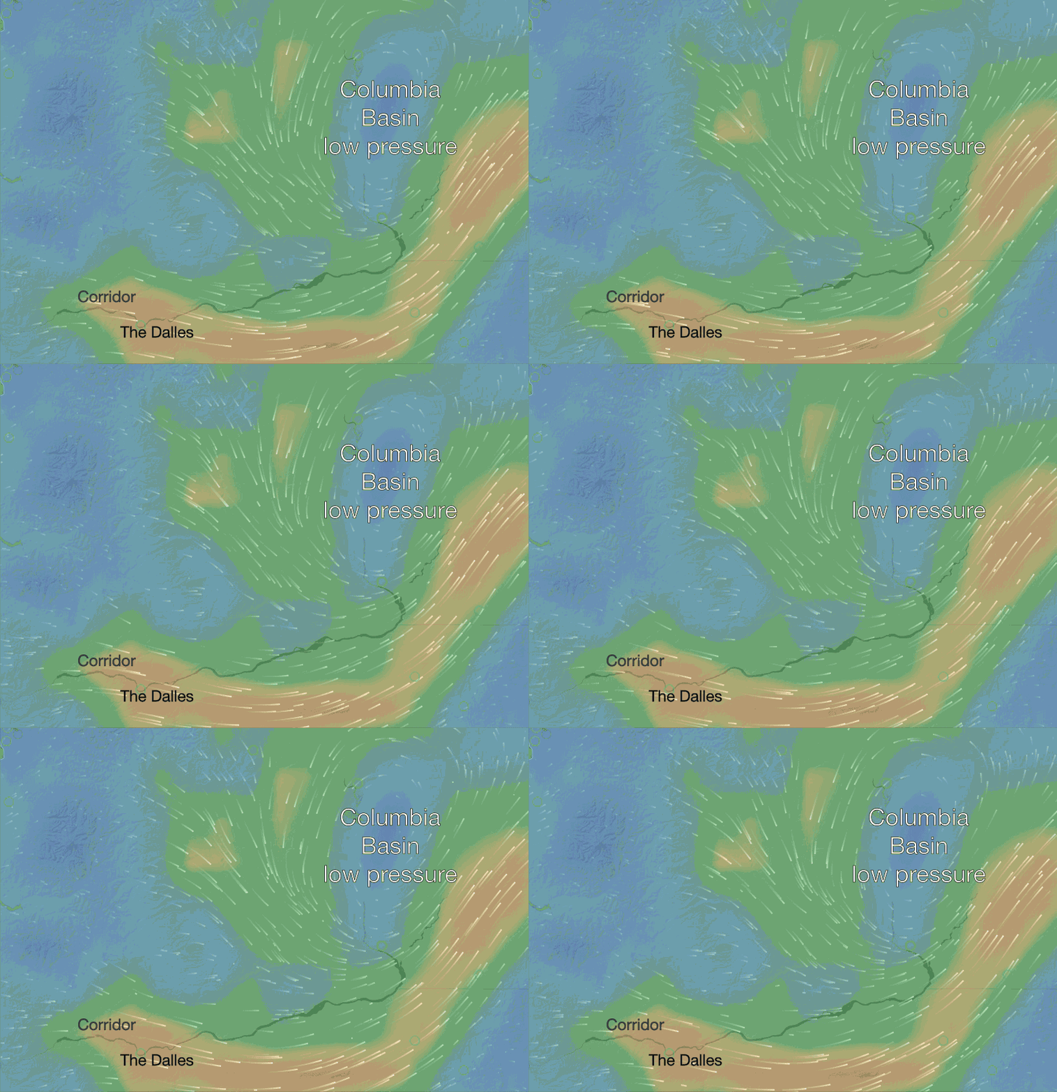
Now really zoom your mind into the upper right corner of the animation to the Columbia Basin. And then look at the cos up below. This is where the thermal  low pressure lives. What is unusual about this coming blow is that the Basin is really not that hot but the low pressure is quite strong. Why? Look carefully and you will notice that there is a counter-clockwise circulation around the low pressure. This is being induced by a spinning low pressure just aloft. And this sucks up the rising air in the Basin which makes the low pressure stronger and the wind in the Gorge stronger. So let’s wait and see if this big blow develops as modeled. Remember when looking at the animations that the current models do not “see” the walls of the Gorge and the resulting venturi effect on the wind velocity.
Note: Unfortunately even the highest resolution model that covers the Gorge, the HRRR model at 3 km resolution, does not resolve the walls of the Gorge. So the models often show the isobars and the strongest pressure gradient in the wrong place. (When I did the forecasting for the America’s Cup preliminaries we ran the WRAMS model at an incredible 250 meters resolution which would resolve the Gorge pretty well. If only windsurfers and kiters had the deep pockets like the AC people) That is one reason Gorge going is so difficult.
