Where were the NW winds yesterday and why are they more likely today
by Mike Godsey, mike@iwindsurf.com
I am glad I was not forecasting yesterday April 22. The night before Mark forecast solid NW winds building along the coast. And Ben, Wednesday morning, was going crazy trying to figure out if the SW flow would finally end and if the NW wind would actually arrive. As you probably noticed yesterday there was only a hint of NW and Berkeley got solid wind from the continued WSW flow. And it was frustrating to see the ocean buoys ramp up from the NW late in the day but that wind never really arrived in the Bay Area. So Ben had to issue one of those dreaded “Backcasts”.
So why was it so difficult to make a correct forecast. If you watched ocean buoys or the local models yesterday it seemed so easy to do a forecast. After all there was strong NNW wind 10 miles west of the Bay Area and all a forecaster had to do is predict when those winds would turn more NW which would bring them to the Bay Area beaches.
The problem is that the wind direction of the North Pacific High’s winds is determined by events hundreds or even a thousand miles away. Basically if the North Pacific High pushes a ridge into far Northern California or the Pacific Northwest the winds off the Bay Area go NNW and rush parallel to the coast. So it is much harder for them to curve into the gaps in the coast range.
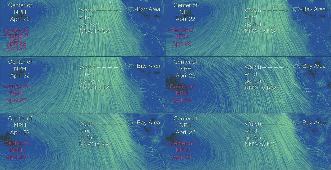
To visualize all of this and why it makes forecasting difficult lets look at this animation. First note the center of the North Pacific High yesterday April 22. Then look at the winds near the Bay Area on that day. Note that they are NNW and notice the eddy just west of the Golden Gate creating WSW flow through the Bay. Now watch the animation as the center of the North Pacific High drops southward today April 23. Note how the winds turn more NW along the coast and how the eddy disappears. Also notice how the NW wind penetrate deep into the Bay Area.
And what made the center of the North Pacific High moved southward? Basically a storm system to the north is pushing the North Pacific High to the south which brings the NW wind closer to the Bay Area cost.
Of course getting this forecast NW wind to the bay hinges on the pressure gradient climbing this afternoon. That hinges on good clearing today. Hence the big HEDGE in the forecast.
