Mild warm up brings improved local sea breezes Friday
by Mike Godsey, mike@iwindsurf.com
You often see the words “Upper level ridge brings warming to Southern California so the inland valleys warm and the pressure gradient ramps up” And probably the geek Upper level ridge part of that statement puzzles you.
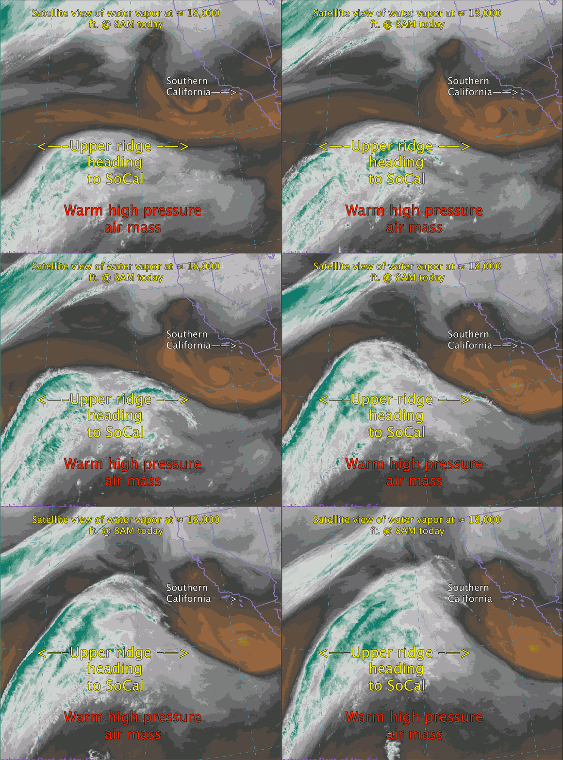
So what is an upper level ridge? Looking at the satellite video from this morning note that is NOT the typical satellite you are used to that depicts the near surface clouds. Instead this satellite detects water vapor from about 10,000 feet and above.
The winds that control the movement of the surface low and highs that make much of our wind are controlled by these upper level winds. So they are critical in forecasting future wind patterns. These winds circulate around the world making northward and southward extending loops. The northward extending loops are called ridges and within them the atmosphere is thicker is descending which creates heating at the surface below them.
Out in the pacific to our SW you can see an upper level ridge that is moving towards Southern California. As this ridge comes over us we will see a mild warm up with the inland valleys hitting the upper 80’s to low 90’s. This will not be a major heat even since there will not be a low pressure in the Great Basin. But there still should be enough heat to create a useful pressure gradient to the inland valleys so the coast wind builds a bit stronger than we have seen in recent days.

