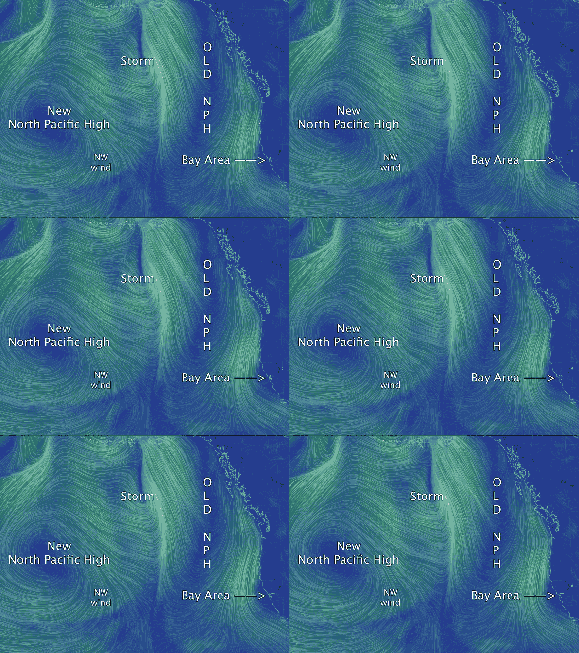
Old crumpled NPH fades away while out in the pacific….
by Mike Godsey, mike@iwindsurf.com
Ok, enough of this! Where the hell is the North Pacific High and our NW wind? The Cut-Off Low has passed and that is suppose to mean NW clearing winds in Southern California and the Bay Area. Yet we are seeing Sherman Island SW winds at dawn today April 12. This is not suppose to happen!
For weeks now you have heard me and other forecasters talking about the North Pacific High but rarely have we seen significant NW wind. Why? Basically the current  version of the North Pacific High has been shoved around mostly to the north by a succession of storm systems too closely packed for the high to have time to move back to the California coast. Worse these systems are distorting the NPH so that it ridges inland over the Pacific Northwest. This is great for the Oregon coast and Gorge wind but it means North wind on the California coast which cannot, given jutting Cape Mendocino, really fill into the Bay Area. And as you saw in the previous blog this northerly flow favors an eddy west of the Bay Area that creates SW flow.
So why are we forecasting moderate NW clearing winds late Monday and for sure Tuesday?
Looking at the video first find the Bay Area and California to get oriented in this zoomed out view. Then find the “Old NPH”. Ideally the NPH should be a large oval with winds spiraling out in a clockwise fashion. This makes NW wind on the California coast and NE trades in Hawaii. But notice how this “Old NPH” has been pancaked against the northern west coast. There are still clockwise winds but note how they are NORTH winds on the coast and do not reach the Bay Area. This pancaking continues tomorrow as the next storm system, which you see in the video, presses against the “Old NPH”. This new storm finishes off the “Old NPH” and it disappears from the models as it is absorbed by passing weather systems.
Now looking at the video notice the “New North Pacific High” that has formed north of Hawaii. The robust NPH is pushing towards the California coast and the NW winds you see on the edge of the high pressure should arrive at the Bay Area late Monday or more likely Tuesday. And this new North Pacific High promises to hang closer to California so expect more reliable NW flow the next week or so.
With thanks to http://earth.nullschool.net
