Forecast Jargon Decoder: Wednesday, July 3, 2024
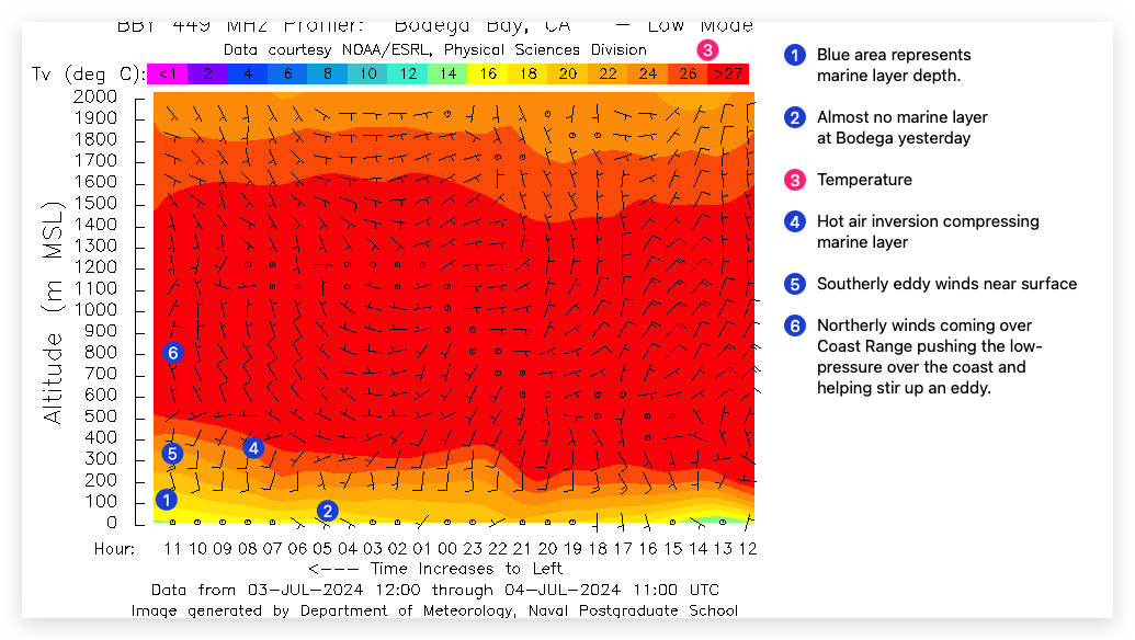
BELOW the heat bubble created by a historic lingering heat wave, a tiny eddy off San Francisco sends a narrow finger of up and down upper-teens to low 20’s wind from mid Golden Gate to Brooks Island & Larkspur and maybe 3rd. Ave. Channel.
Meanwhile, Arroyo, Pismo and Jalama on the Central California coast have only weak southerly eddy winds while Southern California has moderate sea breezes.
All this this happens as:
1. A 3000-mile wide upper ridge ≈ 18,000 feet aloft extends from Russia to North Dokota dumping HOT air over the western USA.
2. South of the upper ridge is a Cut Off Low. This combo STOPS the normal movement of weather from W. to E. so heat lingers for days!
3. At the surface, the North Pacific High extends a ridge over far Northern California into Nevada, Utah and Idaho.
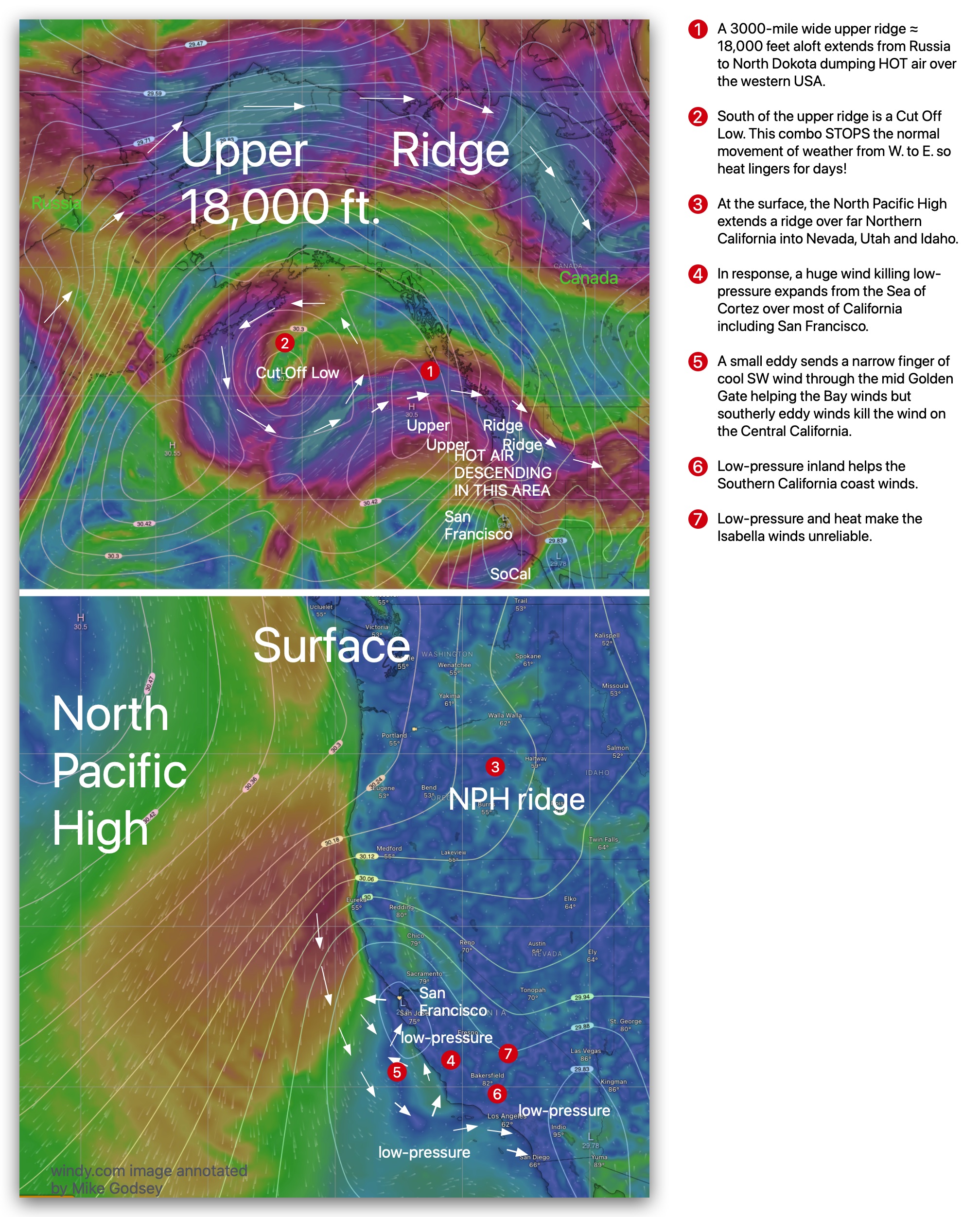
4. In response, a huge wind-killing low-pressure expands from the Sea of Cortez over most of California including San Francisco and Isabella/
5. Near San Francisco a small eddy sends a narrow finger of cool SW wind through the mid Golden Gate. In the LATE afternoon these winds closer to shore and should be usable after a slog.
6. For the Central California coast, the weak southerly eddy winds block any NW ocean winds.
7. Southern California sees local sea breezes generated as the low-pressure retreats inland in the afternoon.
Curious about Bay Area winds? See our wind blogs!