Forecast Jargon Decoder: June 13, 2024
Befuddled by all the meteorological jargon in the forecast? This blog gives you imagery of what the forecast is talking about. Let me know if you find this Decoder useful mail me: mgodseywf@gmail.com
Very strong winds at most sites north of the Bay Bridge + Flying Tigers/Haskins. 3rd. Ave. sees a WSW vs WNW wind battle near shore.
Welcome to the 1980’s with dawn fog and 26g31 winds to Sherman Island. What is causing this Blast from the Past?
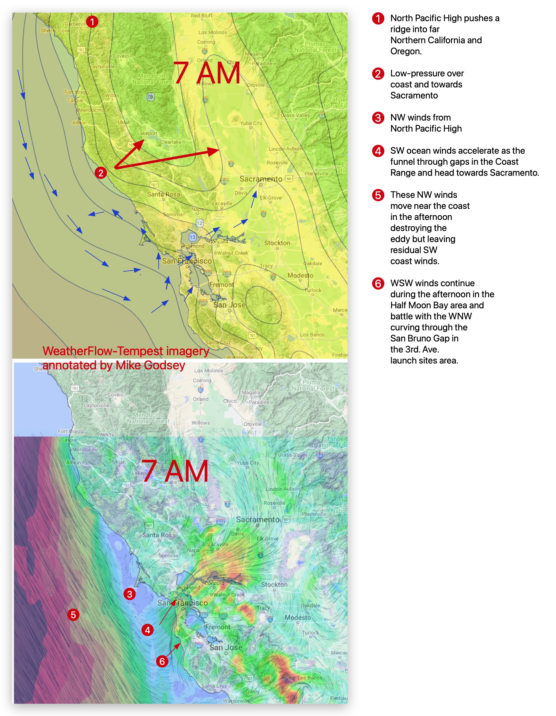
1. A Gulf of Alaska storm is causing the North Pacific High to lean inland over far Northern California and Oregon making a ridge of high-pressure.
2. Which in turn causes a low-pressure area to bulge from Sacramento over the Sonoma and Mendocino coast.
3. Then, out near the Farallon Islands (18 miles west Gate), powerful NW ocean wind curves towards this low-pressure winds creating an eddy and southerly coast winds.
4. Then, the foggy ocean winds accelerate through the gaps in the Coast Range and turn towards Sacramento, creating a strong SW Bay wind.
5. Mid-afternoon, the NW ocean winds become stronger and destroy the eddy, but residual SW ocean winds focus the mid-20s in the Anita Rock to Pt. Isabel/Larkspur to Sherman Island zone.
6. The wind in the Half Moon Bay/Hwy. 92 gap also feels that gradient towards Sacramento and flow near the 3rd Ave. launch sites and battles with the strong WNW flowing from the San Bruno Gap.