Forecast Jargon Decoder, June 16, 6:59, 2024
Do you find these Decoders useful? Let me know mgodseywf@gmail.com
Limp low-pressure from the Central Valley has ballooned out from the Central California over the coast so we are seeing glassy waters below the Golden Gate to Anita Rock. So once again the Crissy wind sock appears in the throes of Viagra deprivation. But fear not, stiff wind from a powerful North Pacific High thrust into the Bay Area commencing ≈ 1 PM.
This happens as the low-pressure moves eastward and then:
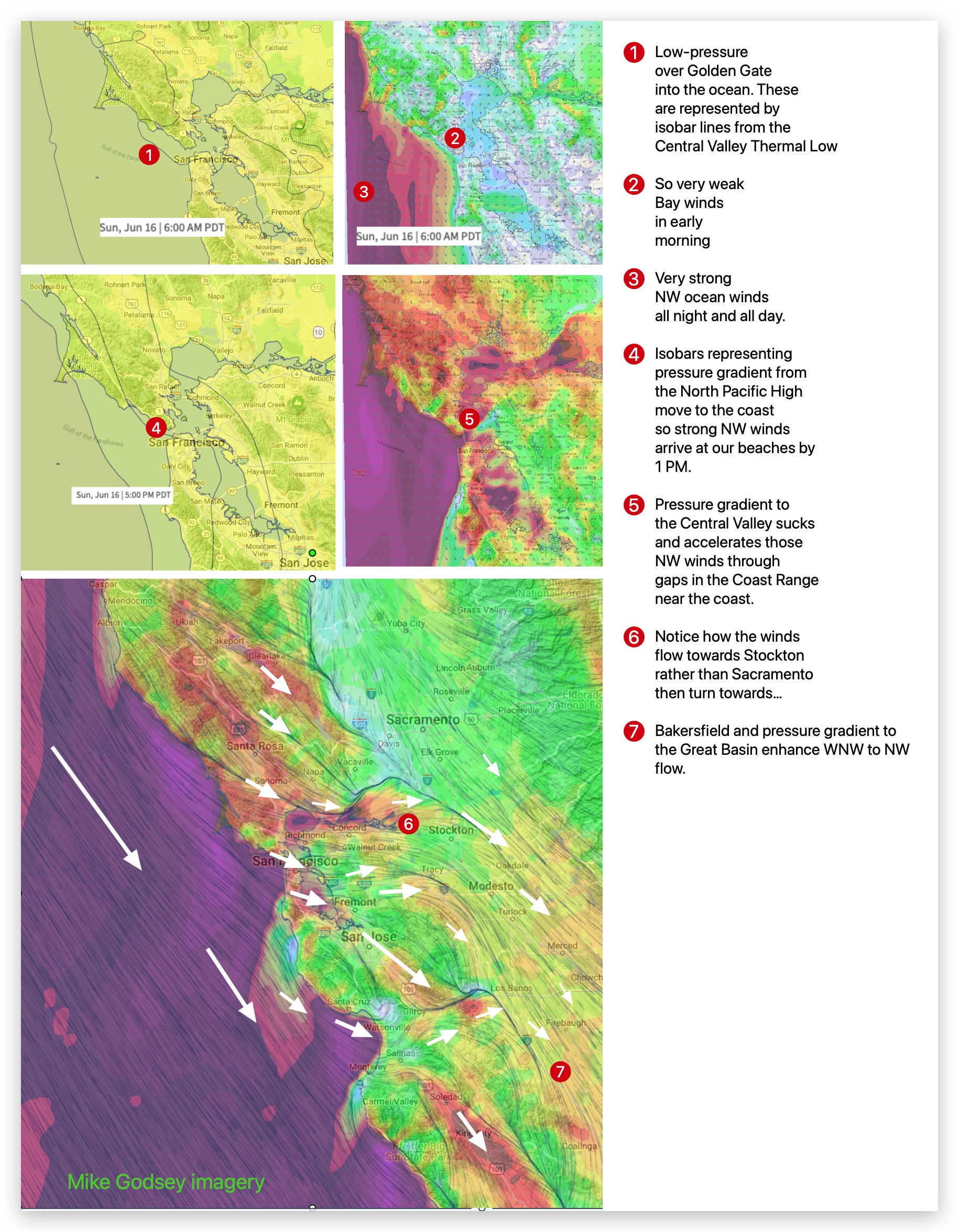
1. The North Pacific High’s surface NW winds accelerate off the California coast due to convergence of the upper level winds.
2. As the Central Valley heats, the strongest pressure gradient is towards Stockton to Bakersfield to the Great Basin.
3. Think about it…this gradient favors NW ocean winds and WNW Bay winds.
4. As these blast over launch sites they find their way to the Central Valley via the Altamont Pass, Niles Road Pass, Santa Clara Valley to the Pacheco Pass.
5. visualizing this, you can see that it favors WNW flow for most lites.
6. Meanwhile, strong NNW ≈ 1000 feet aloft (975 MB) disrupts the Pt. Isabel winds and make many sites gusty.