By Weatherflow meteorologist Shea Gibson
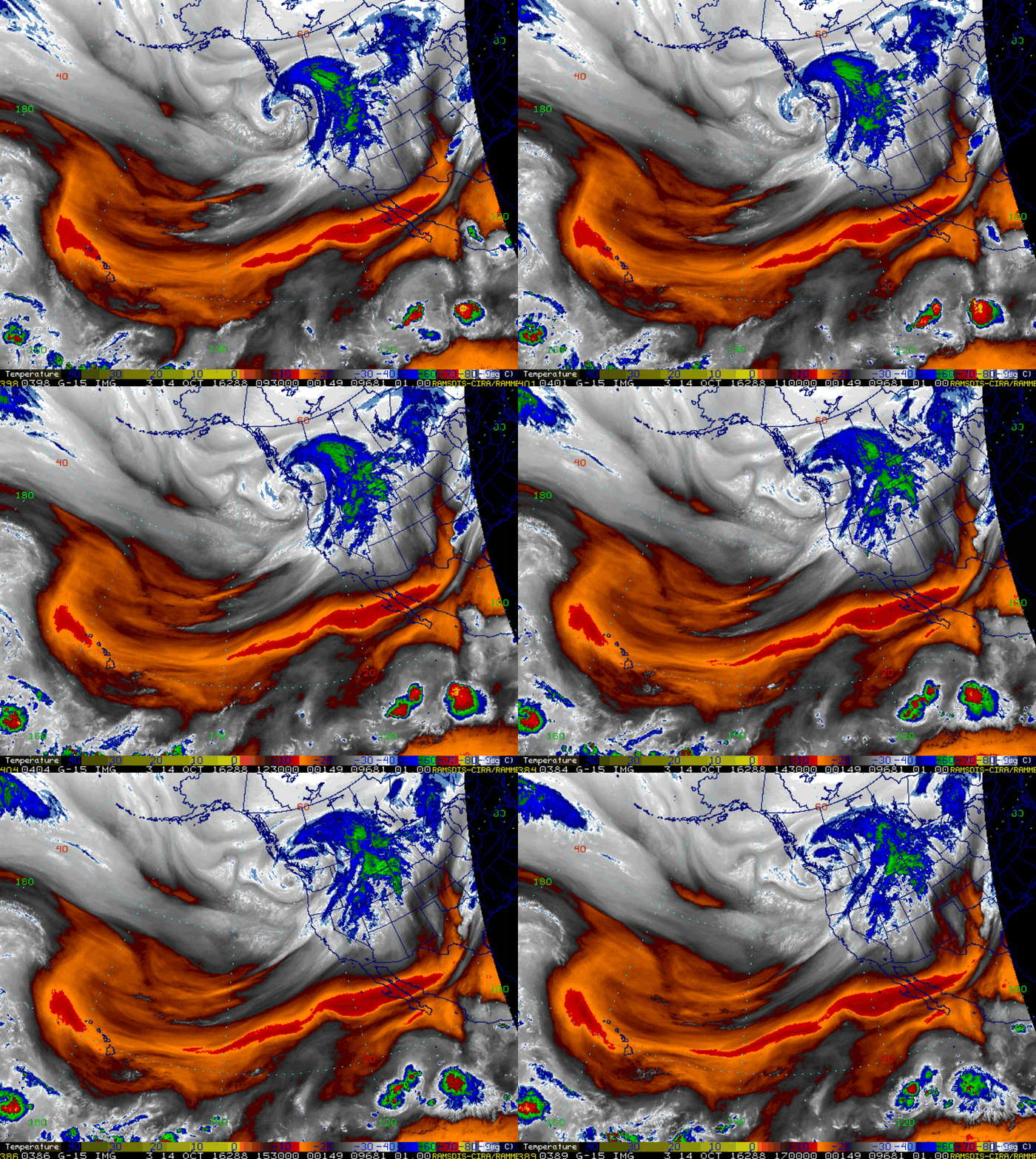
Washington and Oregon have been seeing some very strong winds and dangerous conditions since yesterday and into today. The strong wind belt aloft known as the “North Pacific Jet” (NPJ for short) is taking a dive down over the region with a surge of energy from ex-Typhoon Songda, one of the northernmost super typhoons on record. This is bringing some rather nasty weather their way now – with stronger activity to come. It is their version of the powerful Nor’easters we see on the East Coast at times, but these have a different dynamic setup over the northeast Pacific.
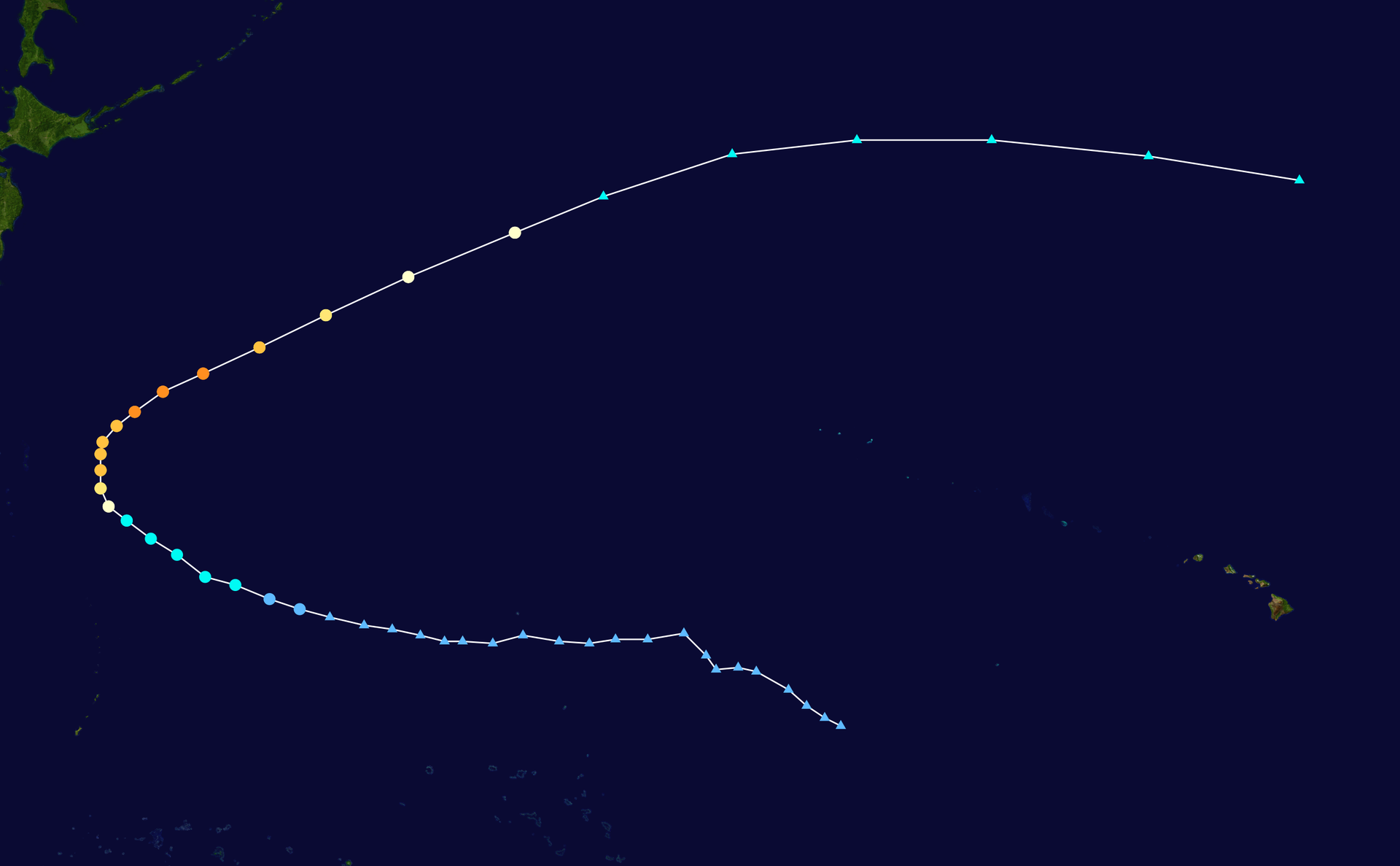
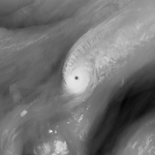
Here is Super Typhoon Songda at its strongest profile. It peaked out October 11, with JTWC reporting (1 minute sustained) winds of 150 mph and pressure at 925 mb. Songda ultimately raced to the NE and got pulled up along the NPJ:
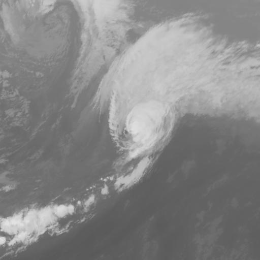
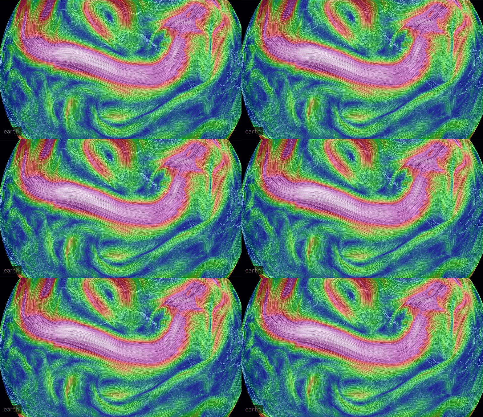
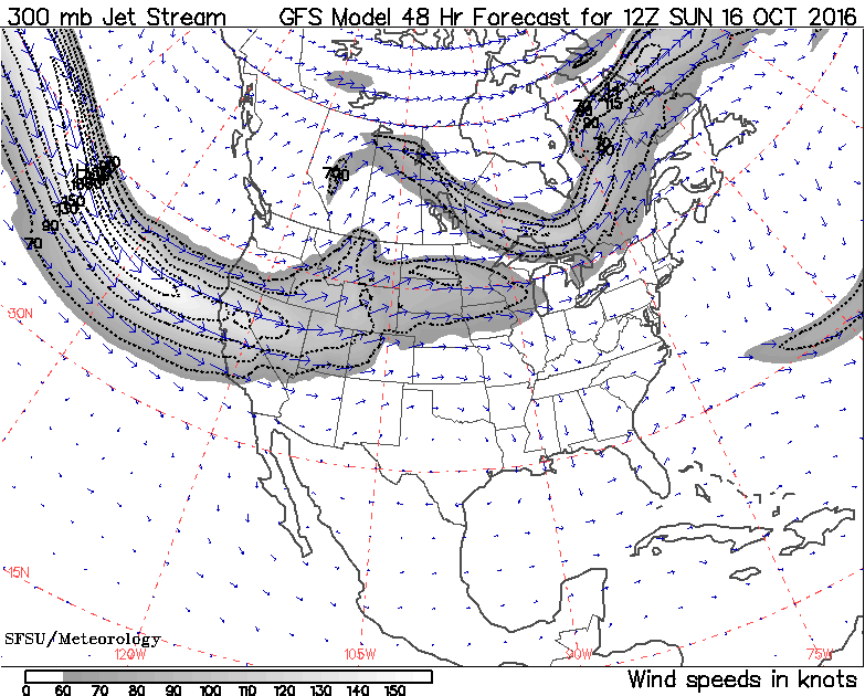
Current jet stream at 250mb (~34,000ft) that Songda was pulled into. The downstream disbursement of energy (or correlation) of one phenomena to another distant location is known as “teleconnection”. The storm we are seeing come together now is a result of that relationship.
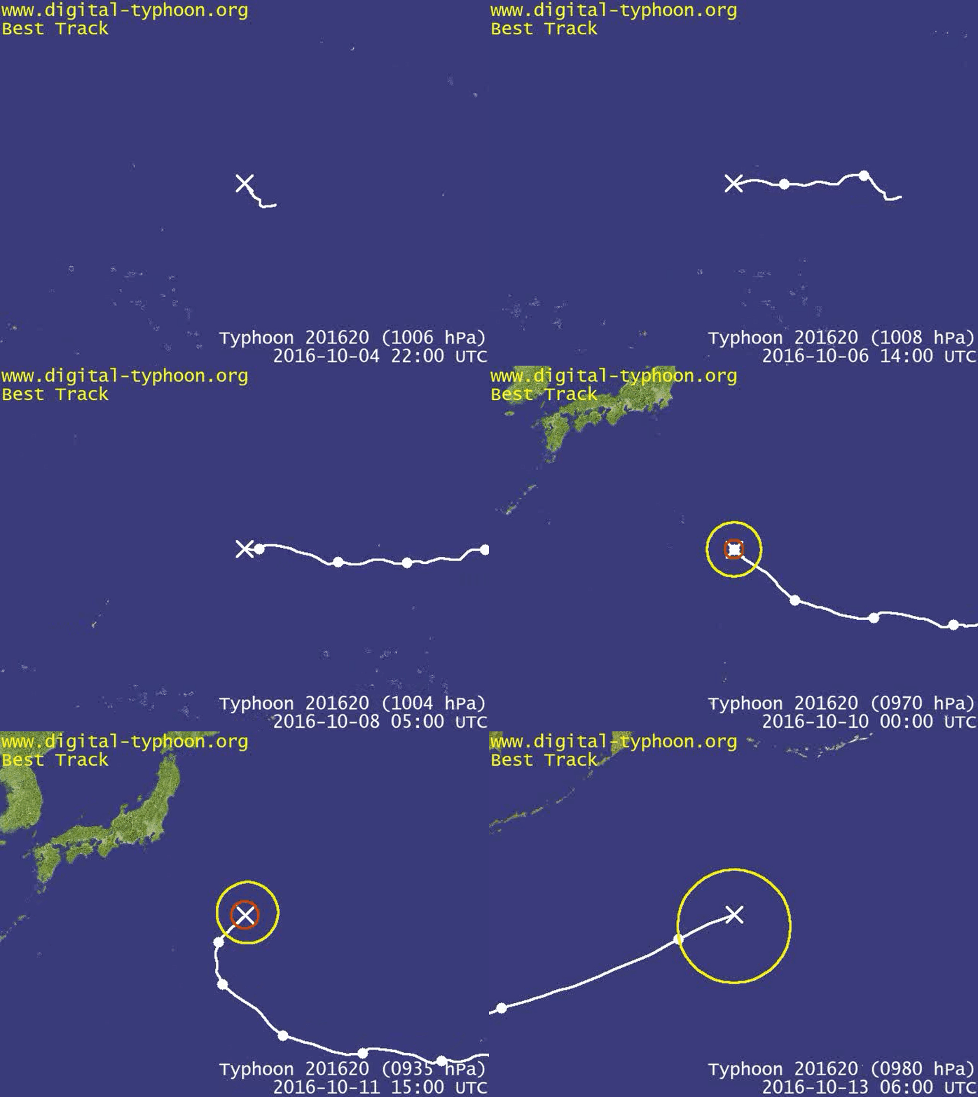
Here is a sped up version of Songda’s track:
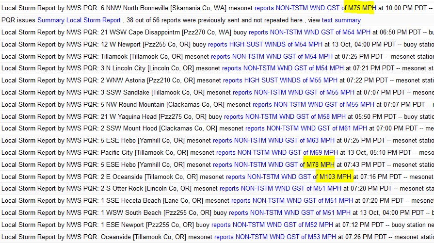
This screen grab was from Jim Cantore of The Weather Channel on the local storm reports from yesterday/last night – notice the high winds reported! Some of these were at higher elevations.
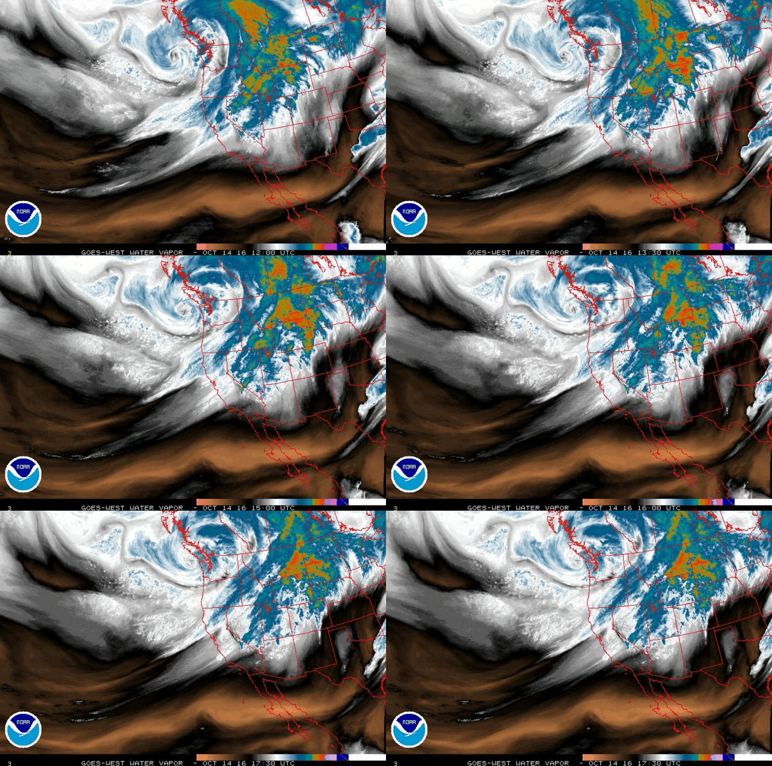
One powerful upper Low is moving over now (as of 1730 UTC)…with another stronger upper Low slated to come in behind it tomorrow.
You can see the jet stream speeding up aloft with an atmospheric river diving down it – this will instigate faster progression of the next storm.
Jet Stream speeds are expected to reach 150kts by Sunday morning. Winds will be very strong in the higher elevations in the mountains Sat night through Sunday.
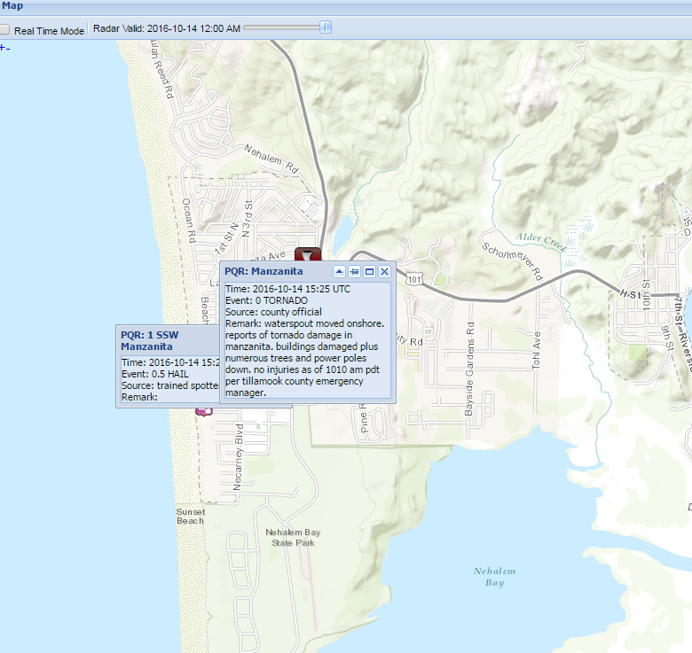
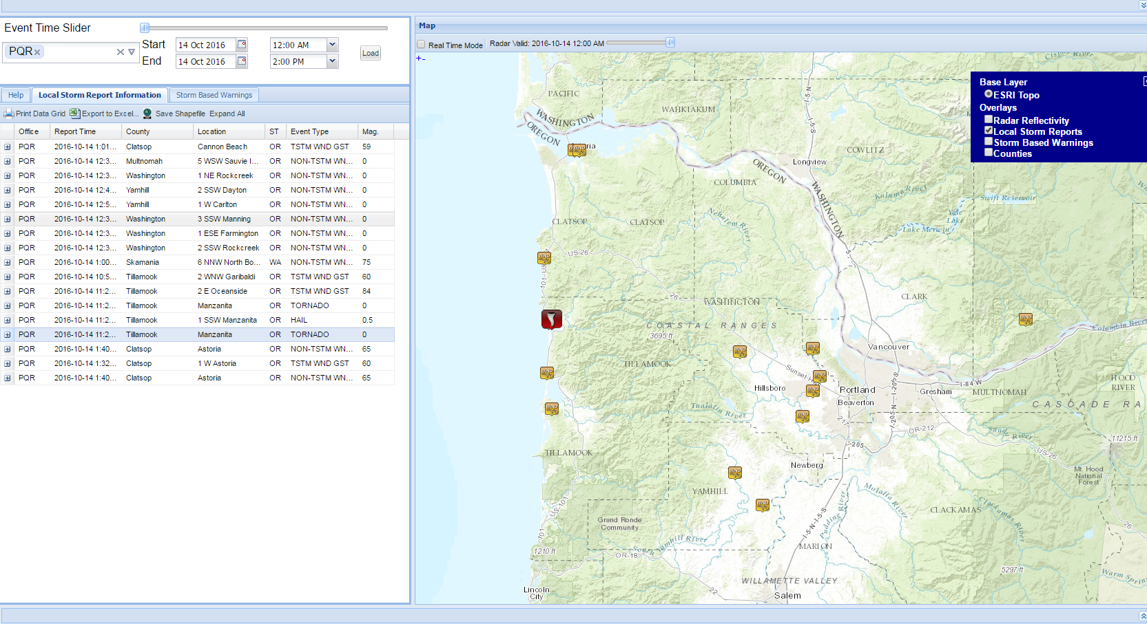
There was a LSR report that came out today that showed a confirmed hail and at least one (currently listed) EF-0 tornado in Manzanita, OR this morning – a very rare sight!
And a chilling video to go with it!
https://www.youtube.com/watch?v=rQCz2iDJwio
Apparently there have been more! The US National Weather Service Portland, Oregon, as of 7:30PM tonight, made this statement via their Twitter acct:

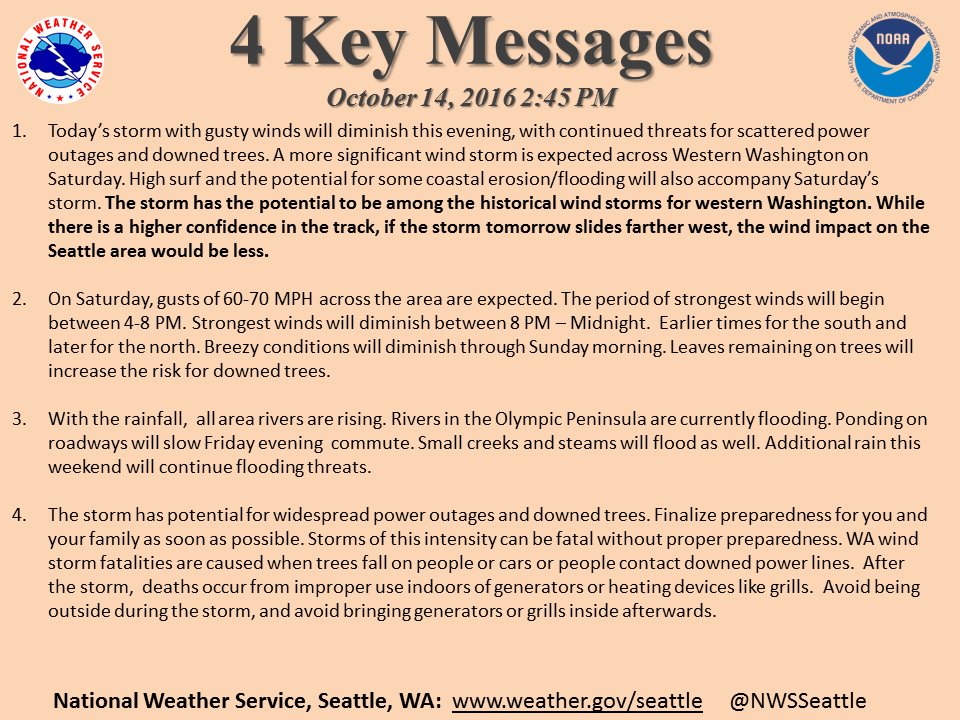
NWS Seattle issued this today as well:
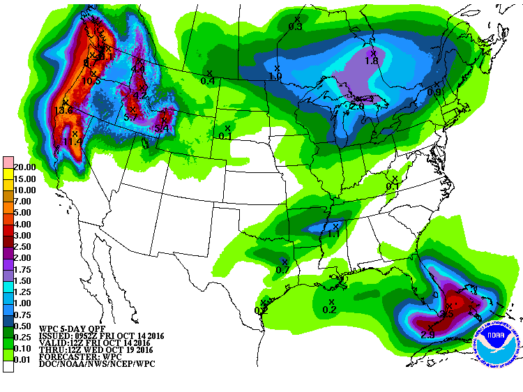
 The 5-day WPC rainfall totals are pretty staggering as you can see – these numbers are in inches.
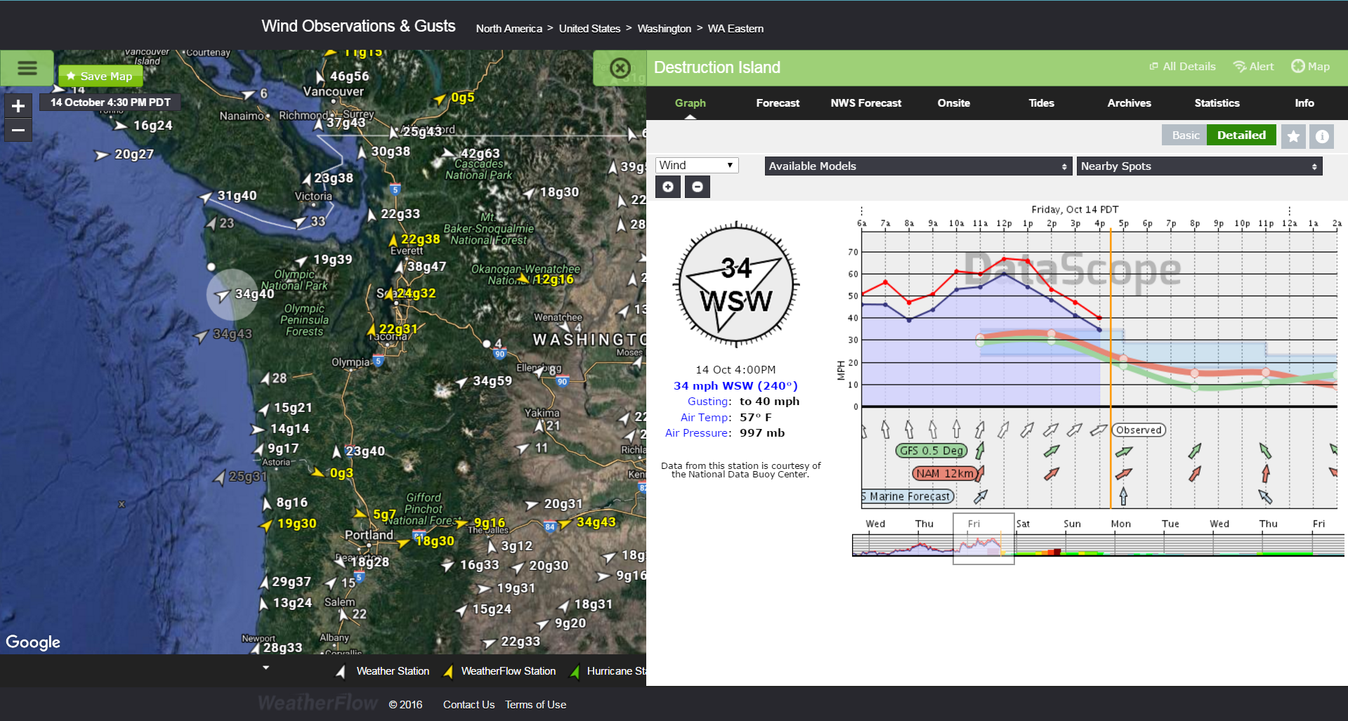
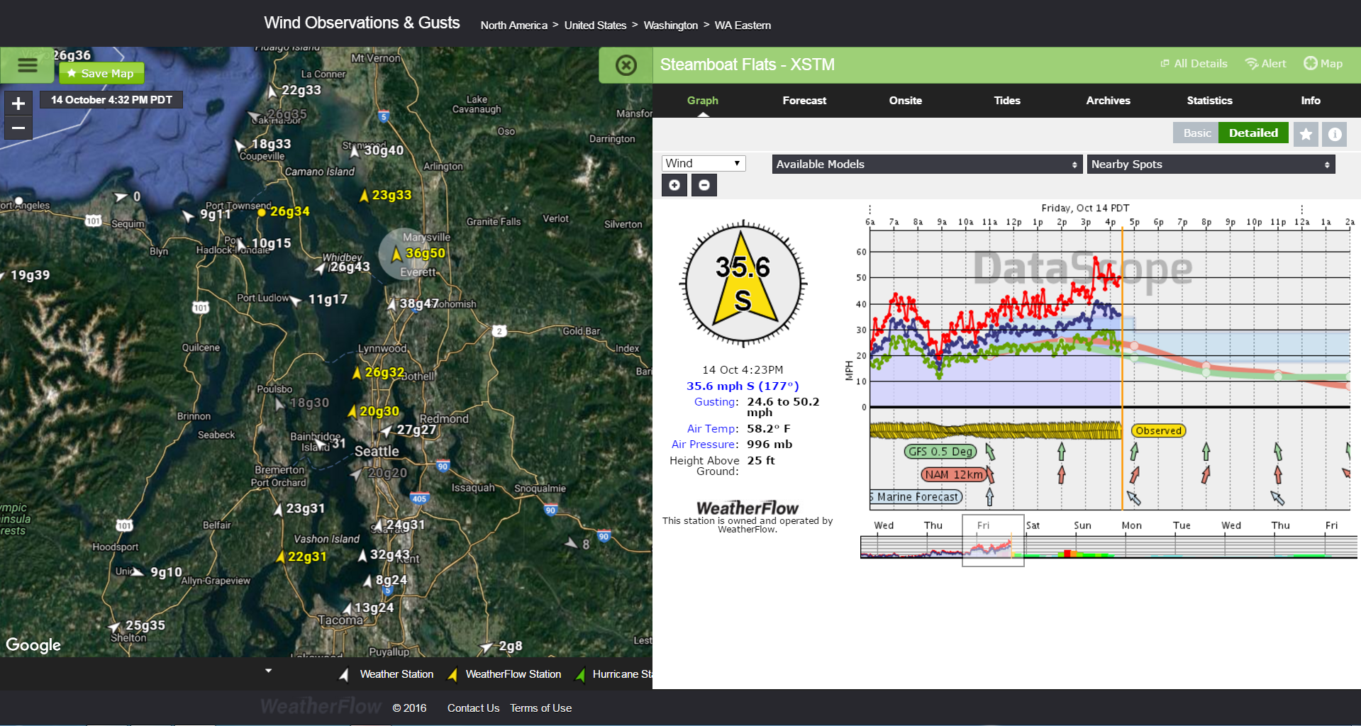
Wind speeds will be reaching possibly in excess of hurricane force speeds in gusts for many spots (especially at the higher elevations). Right now, winds are gusting pretty high around the area. Some locales are seeing winds come down…for now.
Destruction Island:
Steamboat Flats (just north of Seattle, WA) -25FT AGL (ZERO ft ASL)
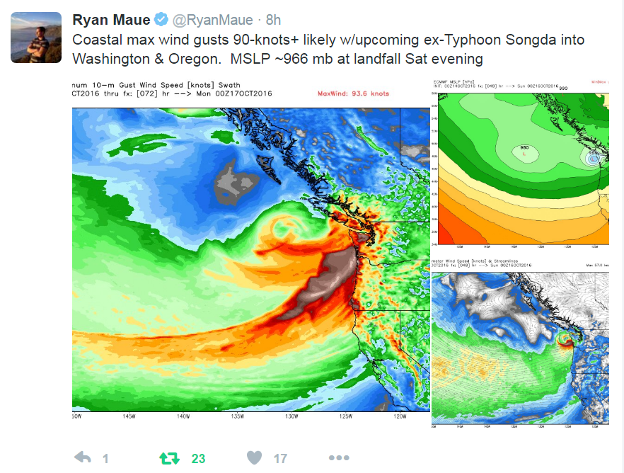
This came from Dr. Ryan Maue of WxBell Analytics today explaining the significance of the event. The lower mean sea level pressure (MSLP) is a sign of intense strength for the storm.
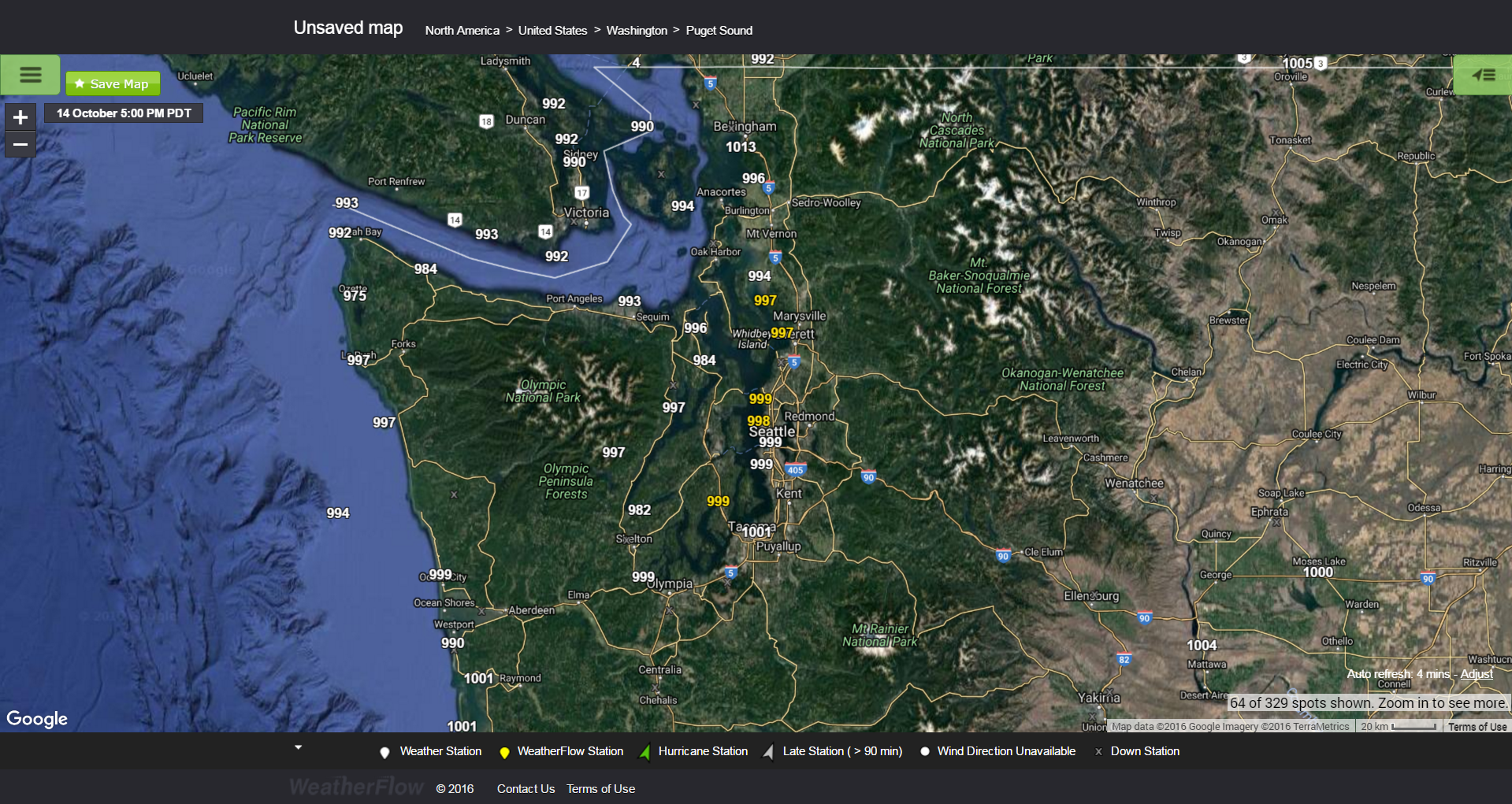
Pressures are already below 1000mb for most spots now (5PM PDT).
Batton down the hatches over there Washington and Oregon! We hope everyone is ok after this one passes. We’ll keep up with the unfolding event over the next 24-48hrs.
Stay safe!
Shea Gibson
SE Region/East Coast/Tropics
Outreach & New Weather Station Projects
Twitter: @WeatherFlowCHAS
Facebook: Shea Gibson – WeatherFlow, Wind Alert
Sources: Digital-Typhoon.org , Earth.nullschool.net, Twitter, our own Datascope products with WeatherFlow, Inc. , Dr. Ryan Maue of WxBell Analytics , Weather Prediction Center , NOAA GOES West, NWS Portland on Twitter, Jim Cantore on Twitter from The Weather Channel, AcaFeLLas, NWSChat LSR reports , SFSU Meteorology , RAMMB CIRA Colostate

