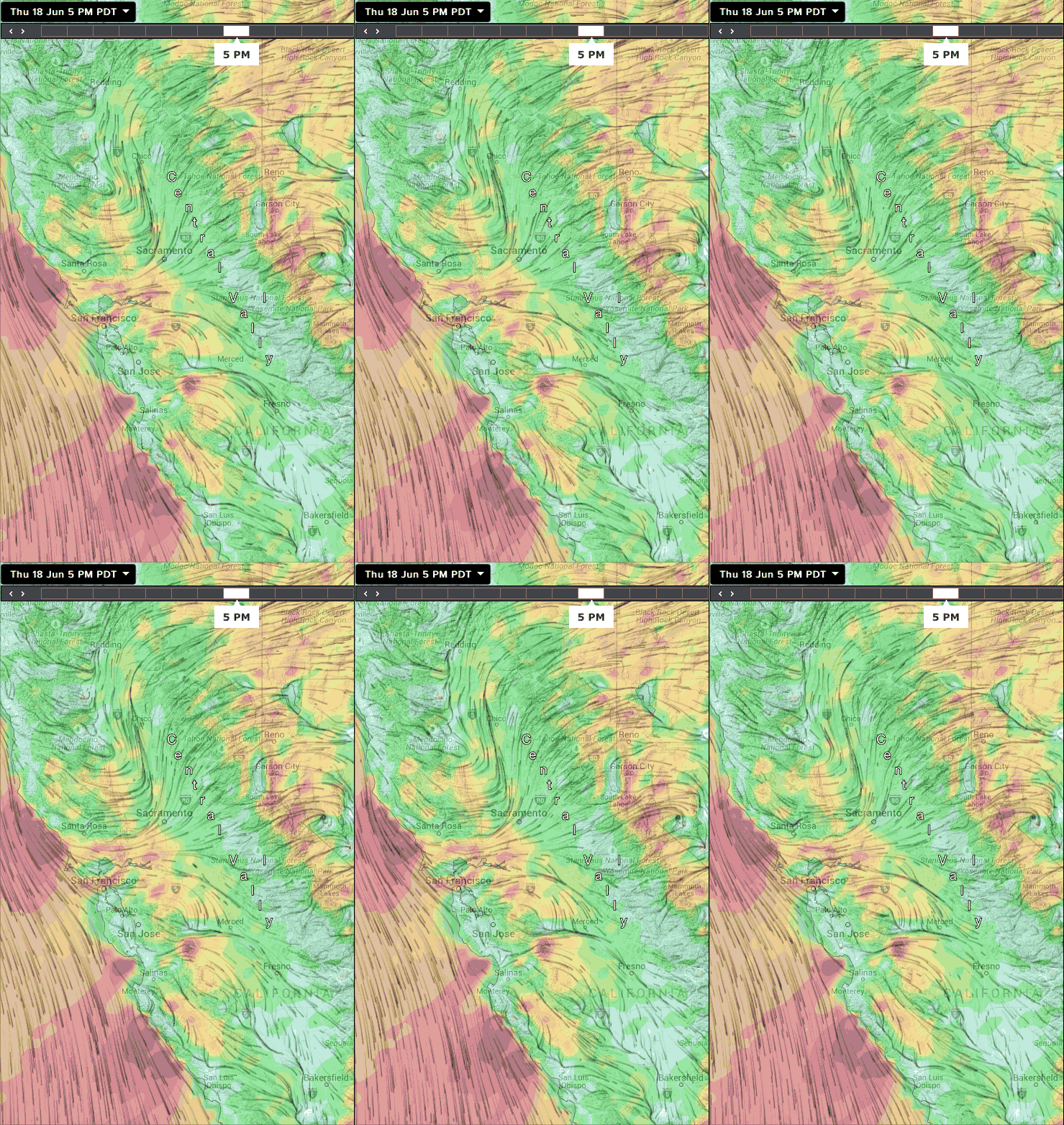
These are the days that almost every Bay Area site gets a fair share of wind! But….

Remember those endless days of SW flow last week that were the bane of the coast and most of the Peninsula?
And I am sure East Bay folks know well those days when NW flow has the coast and Peninsula sites hogging most of the wind.
Well today and probably tomorrow we are in what I call a “Combo Day”. That is my sort of neologism for days when we have NW and SW winds inside the bay. These are the days when most sites have good wind. But they are also the days when the wind can die fast as the balance between NW and SW flow shifts. Pt. Isabel and Berkeley are most vulnerable to this shut down but it can also hit Treasure Island and even 3rd.
The process starts with NW wind at the ocean buoys curving into the bay as west wind. While at the same time there is SW wind just aloft on the Bay Area hilltops.
As the wind enters the Bay through the Golden Gate some of that wind feels the pressure gradient towards Redding in the far northern Central Valley so it turn into a SW wind and heads towards Sherman Island kissing Blunt Point and Pt. Isabel on its journey.
Meanwhile some of that westerly ocean wind feels the pressure gradient towards Bakersfield and turns WNW to NW creating strong wind at most Peninsula sites.
And some of that ocean wind just continue down the coast bringing smiles from Waddell to Natural Bridges.
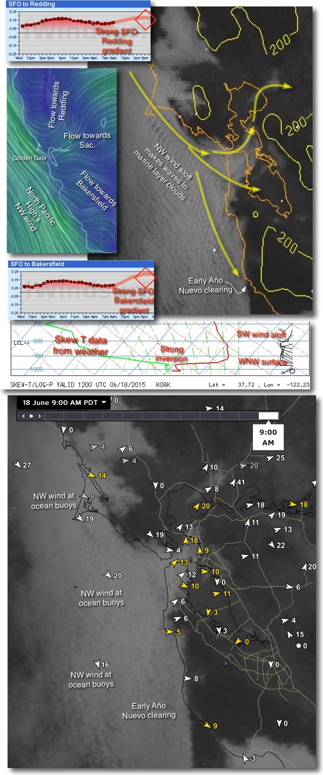
As you can visualize all of this in this video while the graphic below shows many of the factors producing a “Combo  Day”
Day”
First note the strong pressure gradient to Redding in the pressure chart. Now look at the strong pressure gradient to Bakersfield. Looking at the blue graphic you can see the NW wind from the North Pacific High. Note how it curves though the Golden Gate. Notice how part of this wind goes SW towards Redding, part WNW and then towards Bakersfield. Meanwhile much of the wind continues down the coast as NW wind.
Looking at the satellite imagery notice the waves in the marine layer clouds as the wind passes over Pt. Reyes. Then looking towards Waddell note the early Año Nuevo clearing.
Now check out the fog in the Central Bay Area. You can see how the clouds make a curve as they pass over Treasure Island and turn towards Sherman Island.
Drop your eyes to the middle graphic which shows the Skew T from the AM weather balloon from the Oakland airport. We have a strong inversion which presses the marine layer clouds towards the surface and steadies the wind. Also check out the wind direction as the balloon ascends. Note the SW winds just aloft.
Together these are the basic makings of a “Combo Day”…Enjoy!

