by Meteorologist, Kerry Challoner Anderson
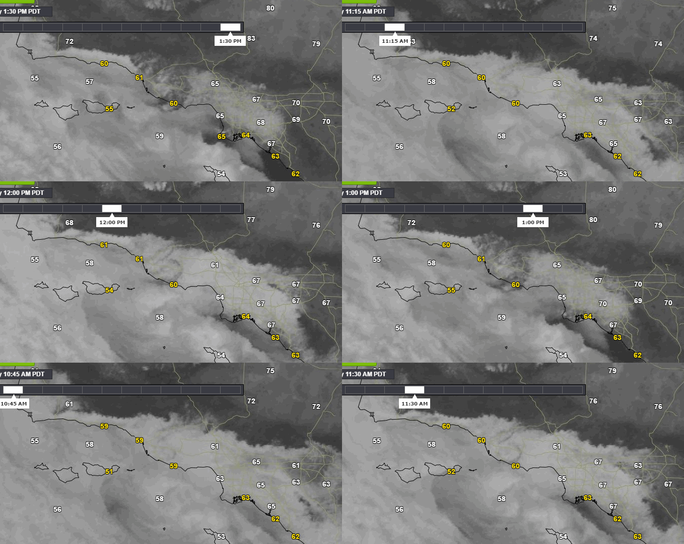
The Marine Layer has been the starring attraction of our forecasts the last few days. I know I have devoted a lot time determining the depth of the layer, how far it will move inland and when it will burn off and then a of print space communicating that information in the forecast. If you think we may have given it too much play these animations will likely change your mind (if all them cycling at once doesn’t give you an apoplectic fit first).
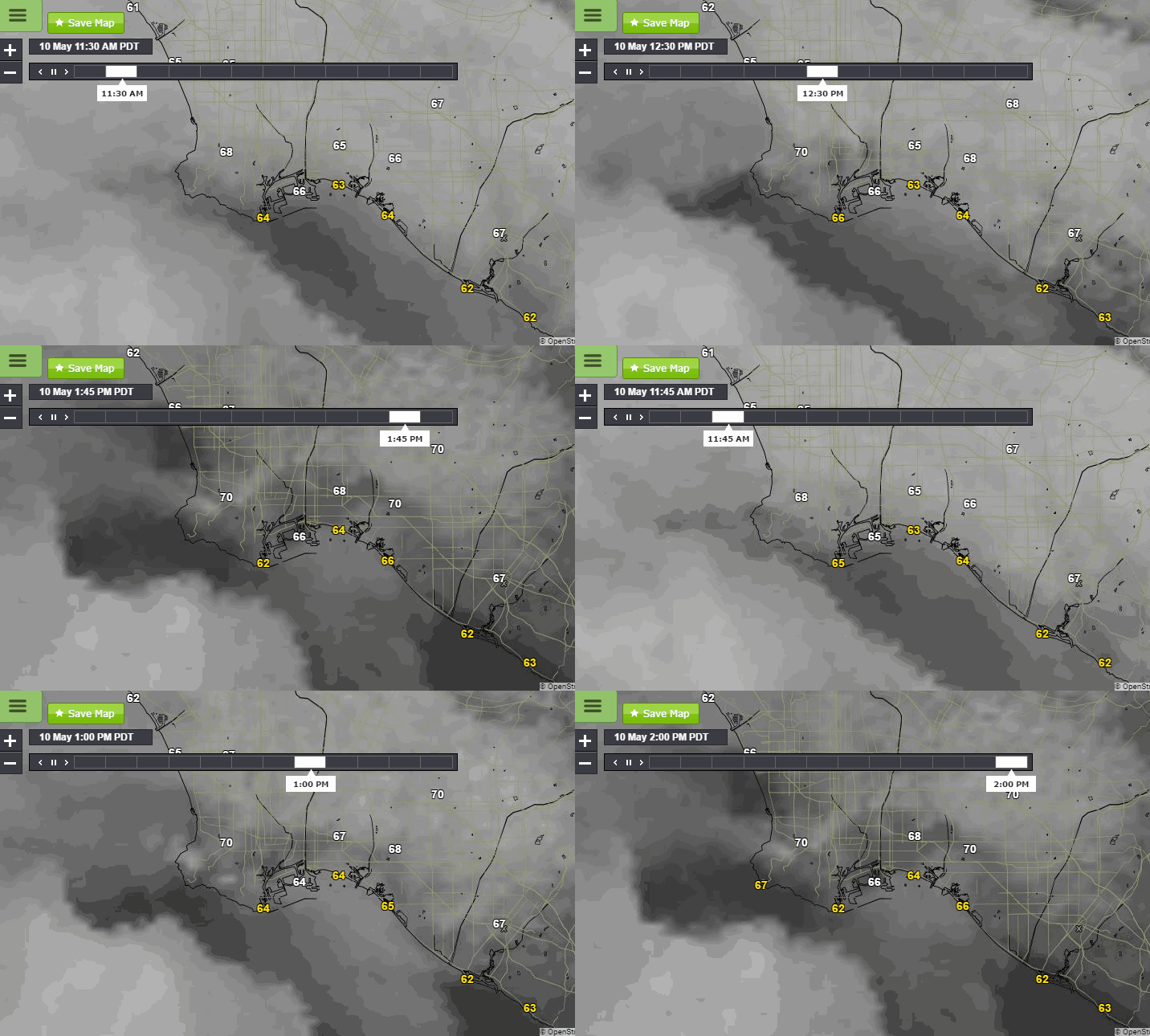
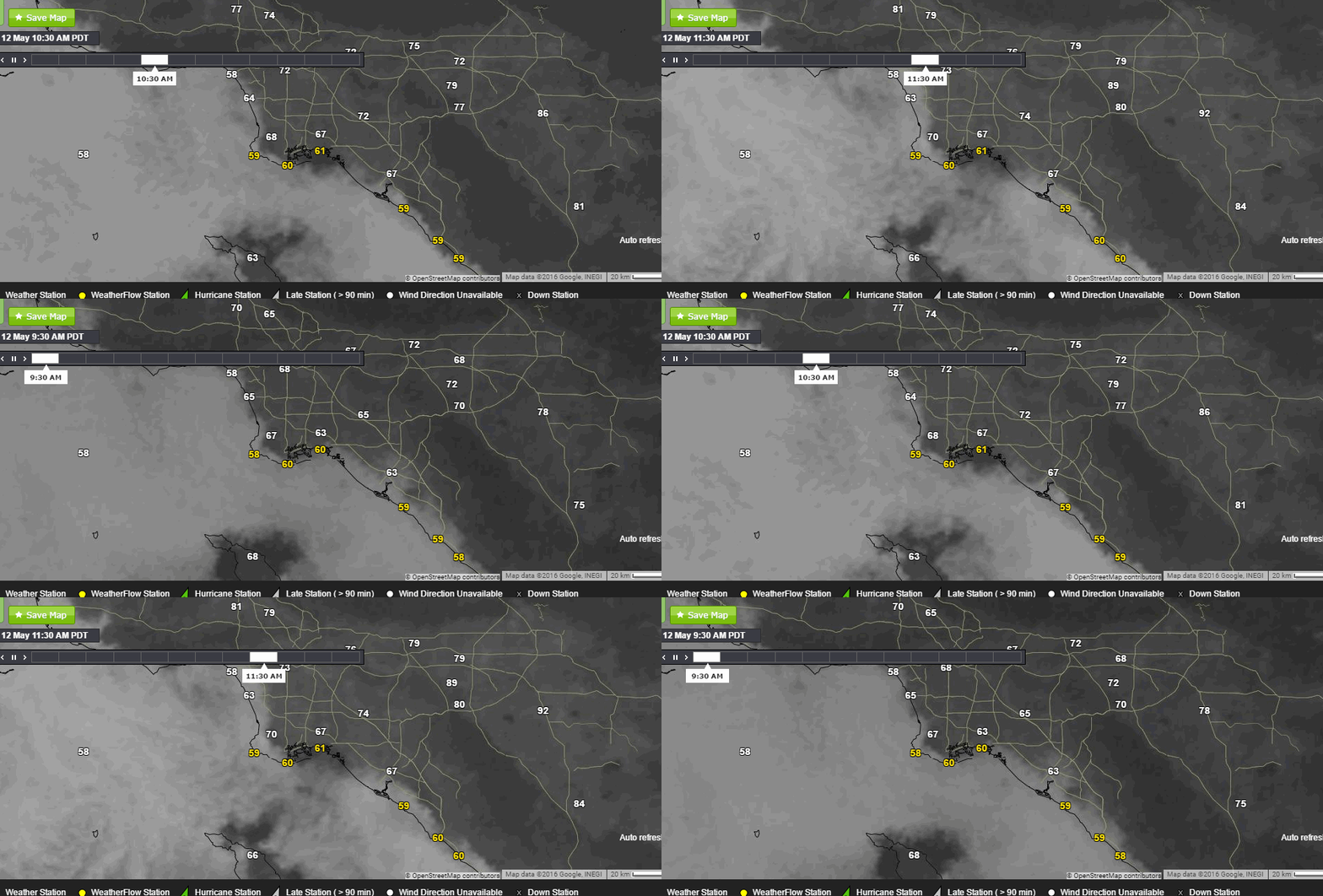
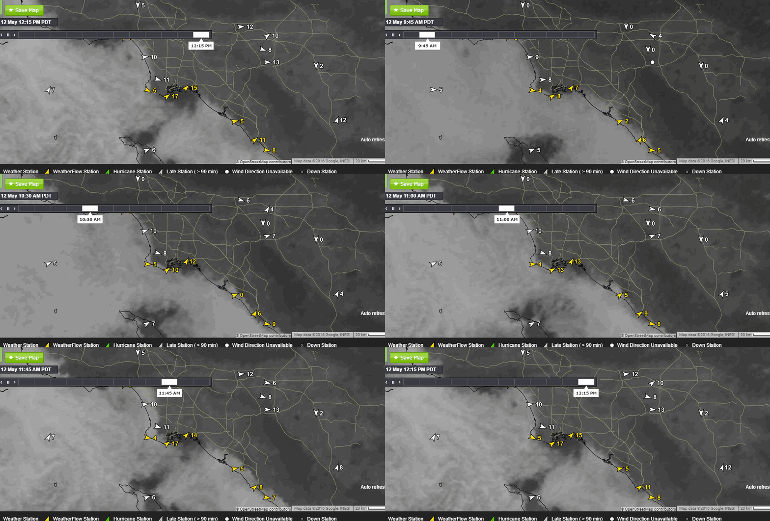
During May and June the Los Angeles Basin sees the most number of hours of marine layer clouds, so many that we locals talk about May Grey and June Gloom. It is important in wind forecasting to be able to predict just how long these clouds will cover the area because they have such a dramatic effect on the local temperatures and hence the sea breeze development. The animation above was taken on Tuesday, May 12 showing the visible satellite picture and the temperatures. As the clouds clear from the Basin temperatures jump quickly rising almost 10 degrees in 2 hours while the coast sees little change.
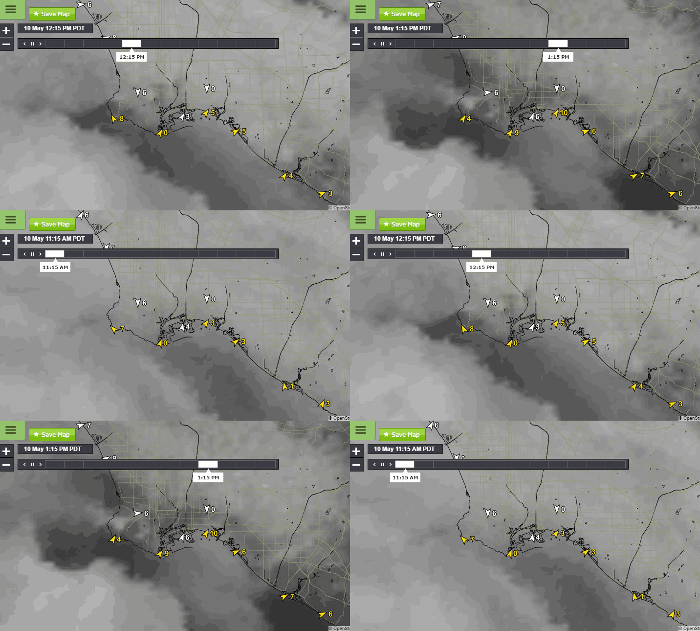
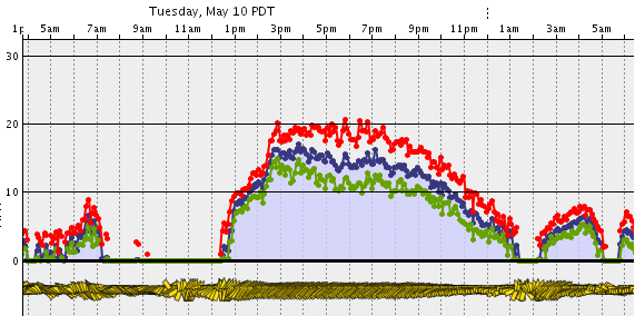
Zooming in a little closer the animations above show the same time period looking down on the Palos Verdes area. Note how quickly the sea breezes develop as the local thermal gradients increase. The clouds hung around the coastline for much of the afternoon keeping temperatures cool at the beaches while the local valleys warmed further and Cabrillo experienced an extended period of upper teen winds. You can see from the graph below that the winds built very quickly starting around 1pm as those marine clouds started to peel back from the LA Basin.
Today a High Pressure ridge has built in over the area. The marine clouds are not as deep and have cleared the Basin much faster. With the descending and warming air with the ridge and more hours of sunshine the Basin is heating much faster as the animation below shows. Chino was already near 90 degrees by noon. As expected the sea breezes got an early jump start.

Cabrillo’s winds had climbed to 10 mph by 11am and to 20mph by 1pm. With these strong thermal gradients in place the forecast calls for these winds to continue through the afternoon. Enjoy!

