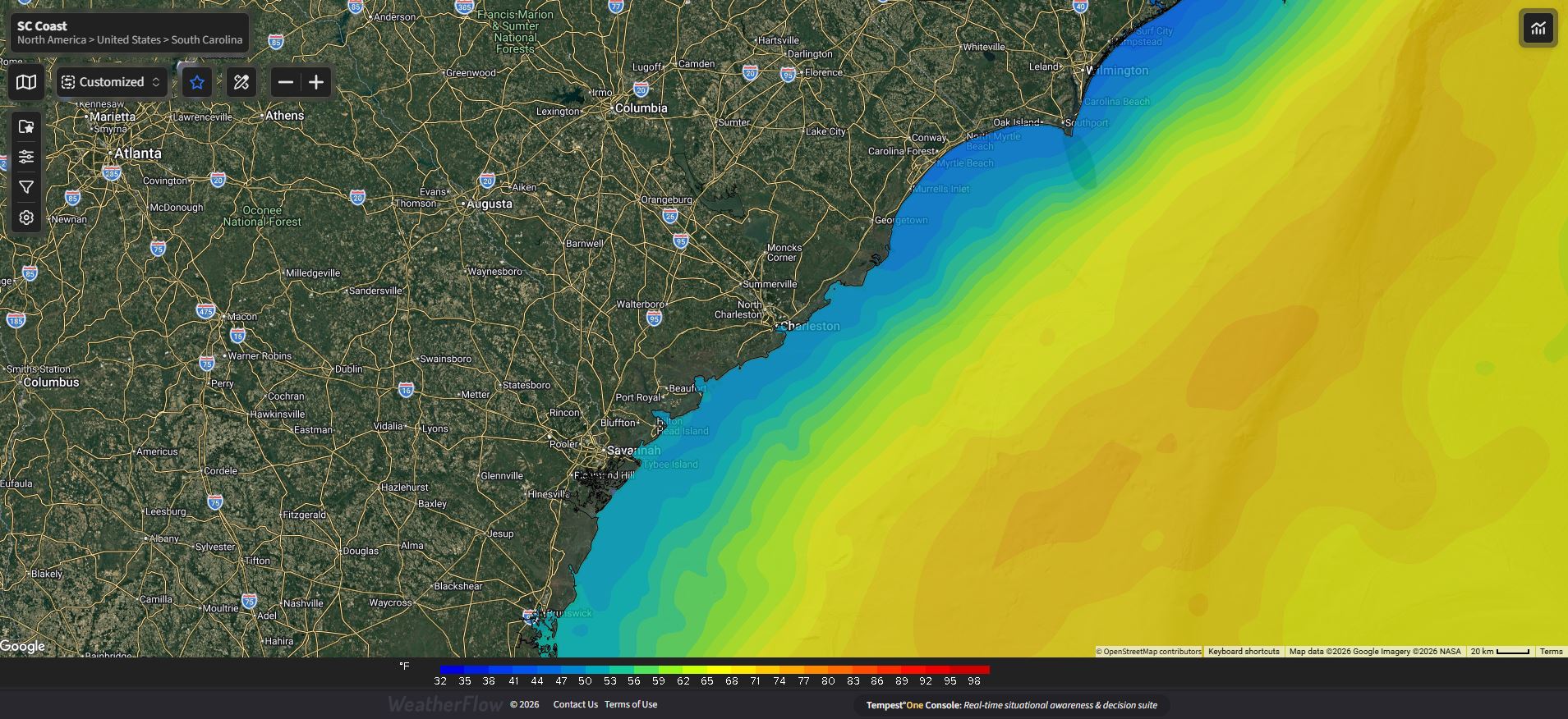
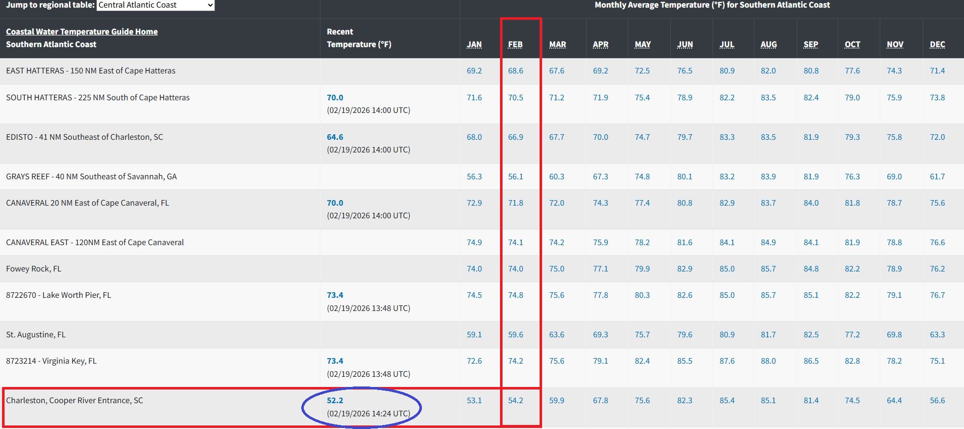
For the Charleston maritimes and along the cooler shelf waters, the sea surface temps are currently at ~52.2°, which remains very chilly after an elongated period of cold weather. It got down to 44° as the lowest recording back on Feb 2nd, 2026 right after our snow event. It has since rebounded and is close to where we should be for avg Feb temps – and we will likely reach the 54.2° avg by Saturday (if not by tomorrow) with this latest string of spring-like ambient air temps. As we start to see warm air surges and the hints of spring, be ready for patchy thick fog events and storm systems that fizzle out until the water temps come up.
Ok so for the Sailors, Kiteboarders, Windsurfers and other wind enthusiasts, how does this affect our warmer Southerly winds?
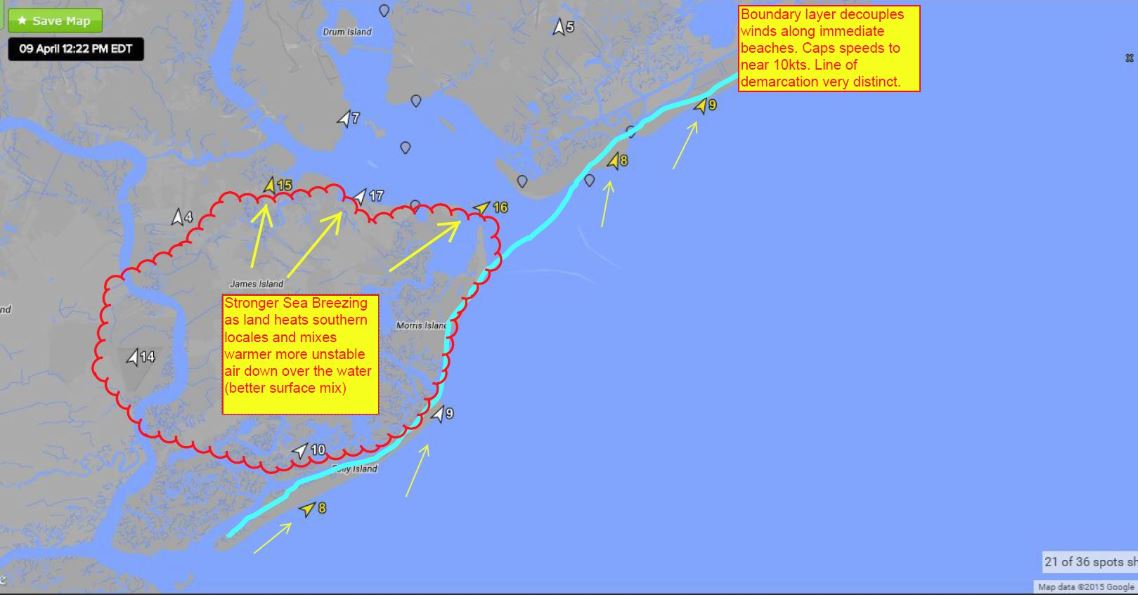
Answer: There is less wind along the beaches due to cooler air stabilizing in off the cooler shelf waters…and much stronger winds inside the Chas Harbor, ICW and uprivers due to warm land mixing with it to create downwind “instability”. Think about cool air moving over warmer barrier island land masses and mixing down on the other side in the harbor. That is what makes for the accelerated stronger winds that can be very gusty. Meanwhile along the beaches, the flow is much more tranquil and weaker.
Well when do these Southerly winds start to match what we see in the the harbor? Answer: If may never exactly match it, but it starts to get close when air temps are closer to what the water temps are. For sea breezes, convective properties of water start to increase as it warms. For tropical cyclone activity, the magic number is ~82°F for a storm to really get cranking, but we can see it locally here for sea breeze activity to increase starting around 74-75°. It’s not exact, but it’s a solid number I have seen over years of observations. Happy hunting for the wind sports enthusiasts as we wait patiently for some balance to arrive!
Stay safe and God speed!
Shea Gibson
WeatherFlow Meteorologist
Referenced Links:
Sea Surface Map: SailFlow https://www.sailflow.com/
Water Temp Table: https://www.ncei.noaa.gov/access/coastal-water-temperature-guide/all_table.html#catl
Graphic Illustration of winds across land by Shea Gibson in article link https://blog.tempest.earth/drawing-a-line-in-the-water/