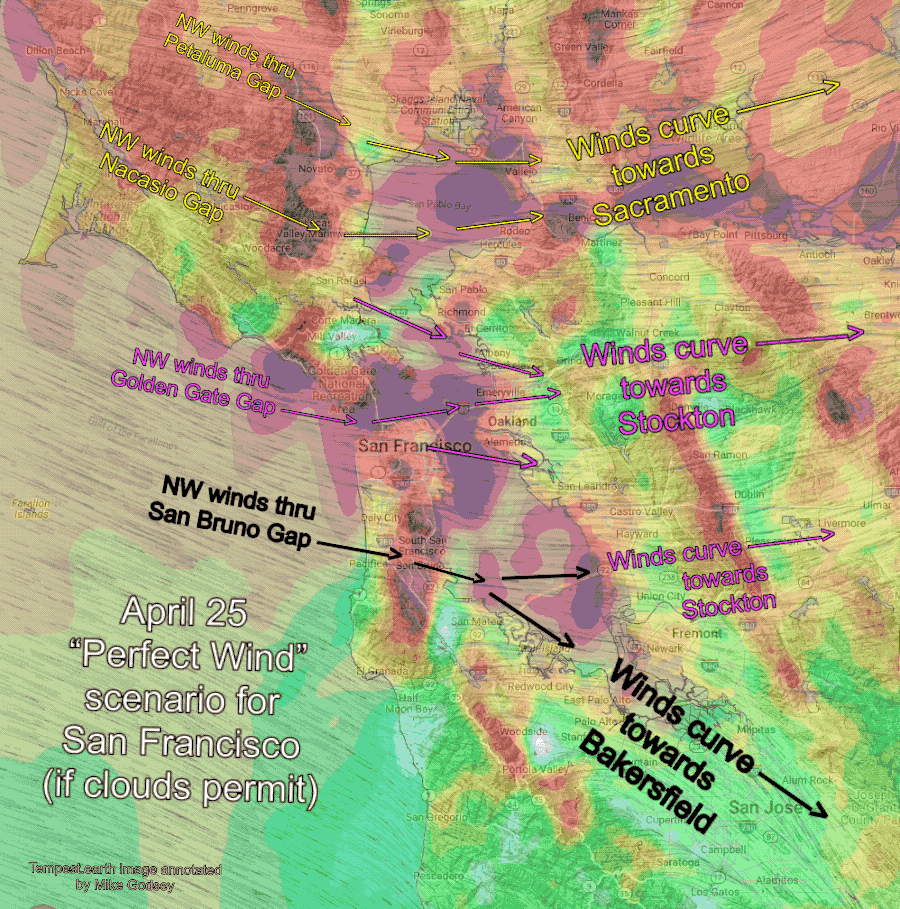
Max pressure gradient split between Sacramento, Stockton and towards Bakersfield so NW ocean winds accelerate to almost every site that CLEARS.
Mike Godsey
Forecast Jargon Decoder, April 25, 2024
The eddy and its southerly winds are history as low to mid-20’s winds develop due to:
1. a 3000-mile wide dome of high-pressure, the North Pacific High’s NW ocean winds reclaim our coastal waters.
2. Mid-day, those winds accelerate as they compress through gaps in the Coast Range (such as San Bruno Gap, Nacasio Gap, Alameny Gap, Golden Gate, and the Carquiniz Strait). You can find some of these gaps in the animation above. Note that the milder NW ocean winds accelerate as they are compressed passing through these gaps. Remember that the model can NOT resolve the size of most of these gaps, so the actual acceleration zone is much narrower than shown in this model output.
3. These winds fan out to every Bay Area site as they flow towards the Central Valley.
4 This ideal pattern happens because the max pressure gradient is pretty evenly split between Sacramento, Stockton and towards Bakersfield
5. Strong turbulent NW winds just aloft bring A. EARLY WINDS B. Add a GUST factor and C. Drive the wind to the LAUNCH SITES at almost every site, including Ocean Beach. USE CAUTION LAUNCHING KITES!
6. Fog may weaken wind near the coast